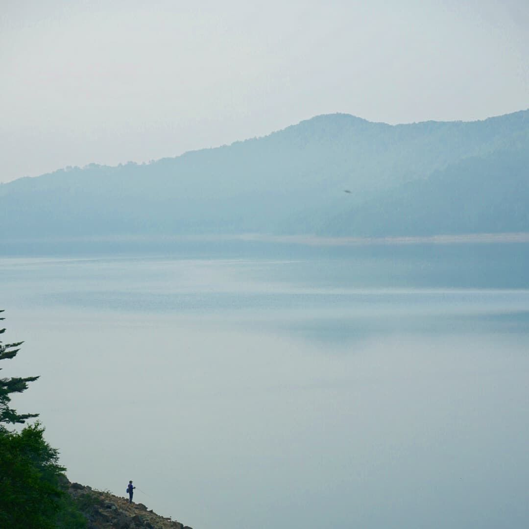
I woke up at Lake Nozori in the mountains of Gunma Prefecture, grateful for the first comfortable night in weeks. It was the hottest summer I'd experienced in Japan. Down in the valleys, temperatures sat between 35 and 40 degrees, the kind of heat that turns a campervan into an oven. Up at the lake, it had dropped to 27 overnight. I could breathe again. Fishermen stood at the shore in the early morning mist, casting lines into water so still it looked like glass. It was barely six o'clock. By nine, I would be standing at the highest point any national road reaches in Japan.
The Roof of the Road
Route 292 runs between Kusatsu Onsen in Gunma and Shiga Kogen in Nagano, roughly 45 kilometers of mountain road that climbs from hot spring town to volcanic moonscape. Unlike the Hakusan White Road, this wasn't an accident. I knew about the highest point and drove here on purpose. The Shiga-Kusatsu Road, as the locals call it, is one of those drives where the destination is the road itself.
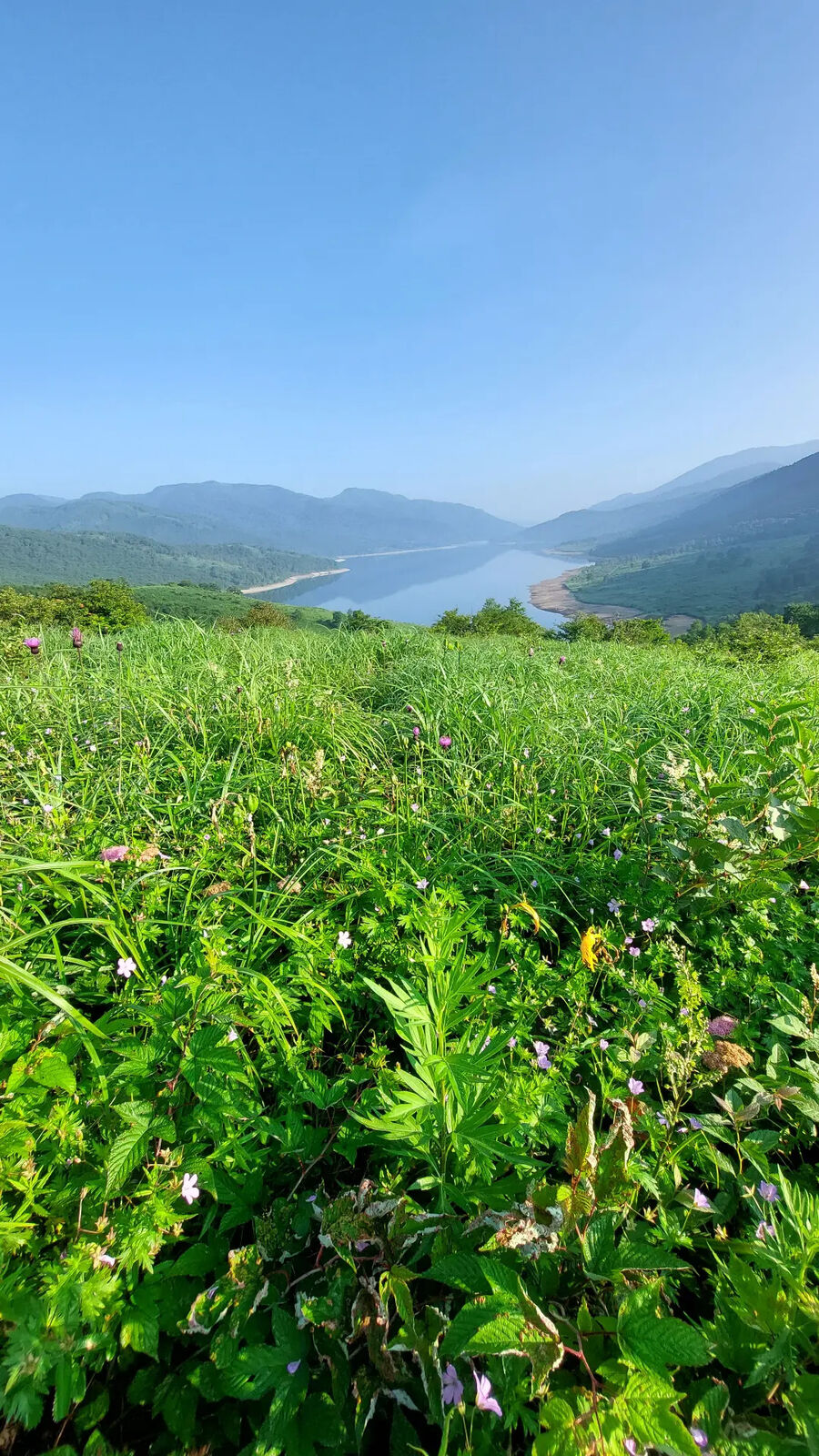
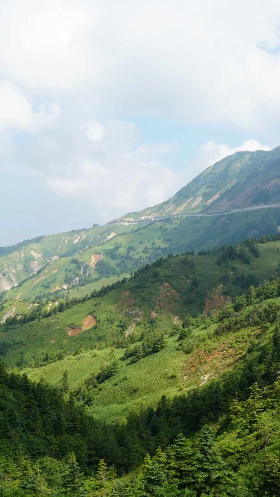
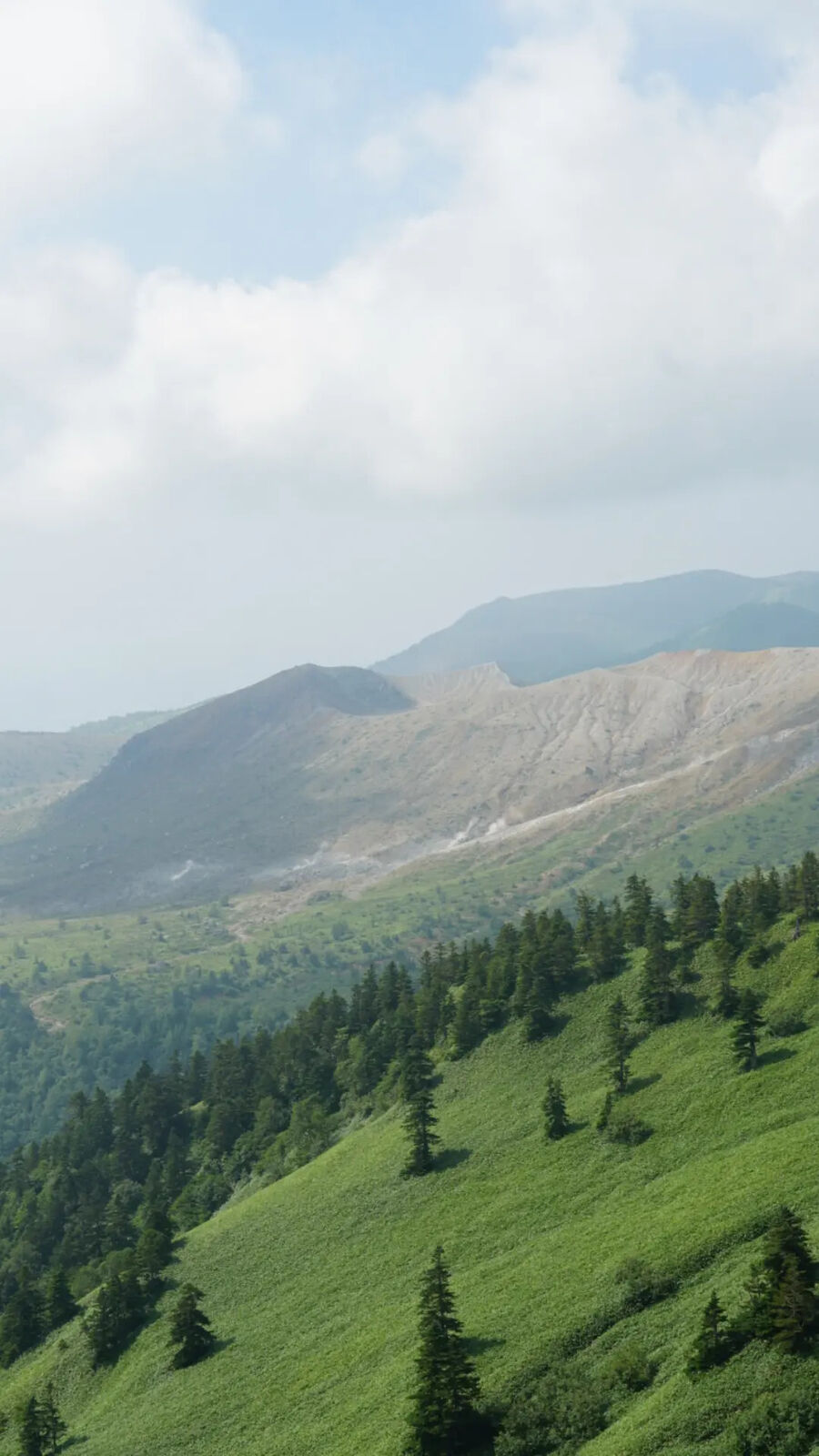
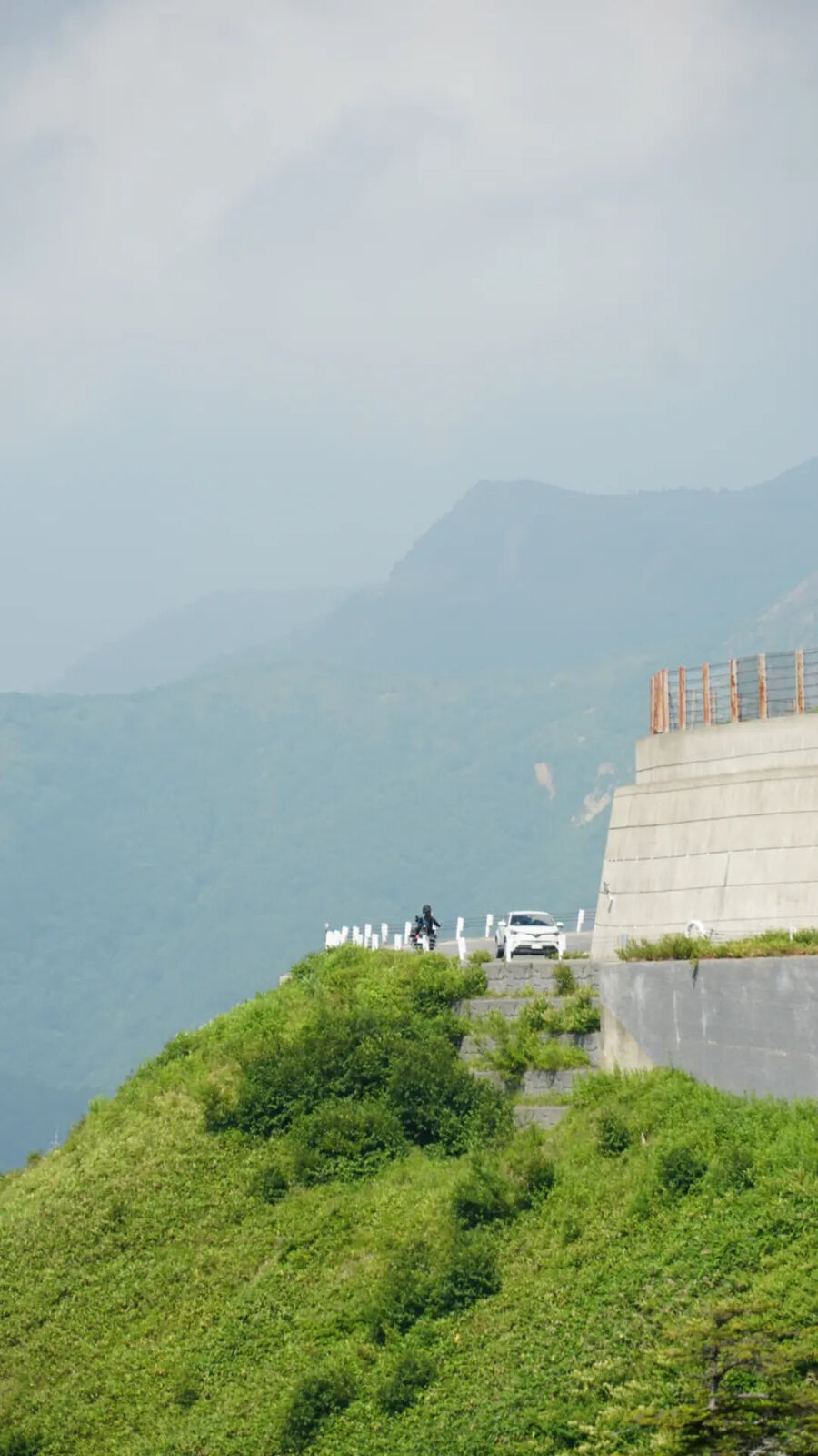
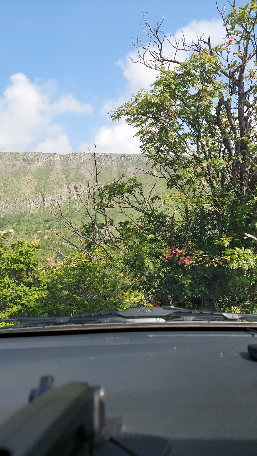
From the Gunma side, the road climbs steadily through forest that gets thinner with every switchback. Alpine meadows replace the trees. Wildflowers line the roadside. And then the landscape changes entirely. The green gives way to something bare and grey, volcanic rock and sulphur-stained earth stretching across the mountainside. You're driving along the flank of Mount Kusatsu-Shirane, an active volcano, and the road keeps reminding you of it.
Mount Kusatsu-Shirane
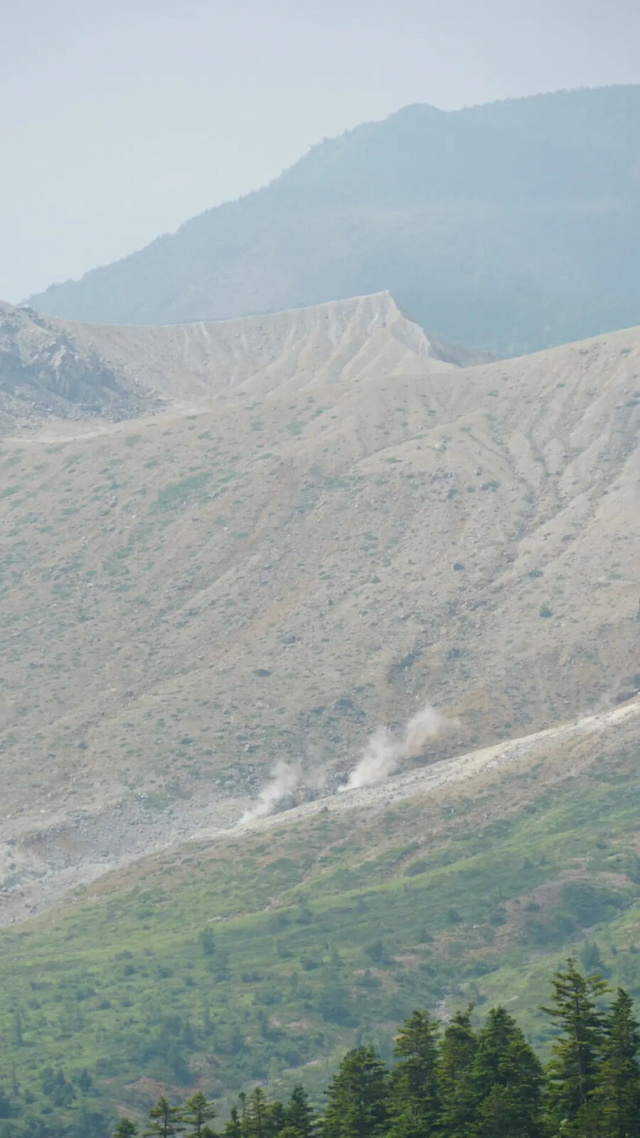
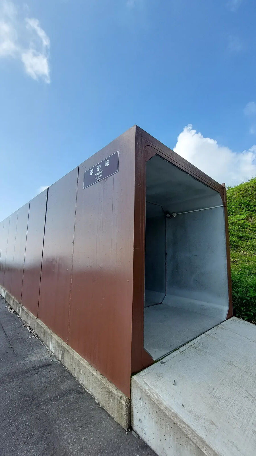
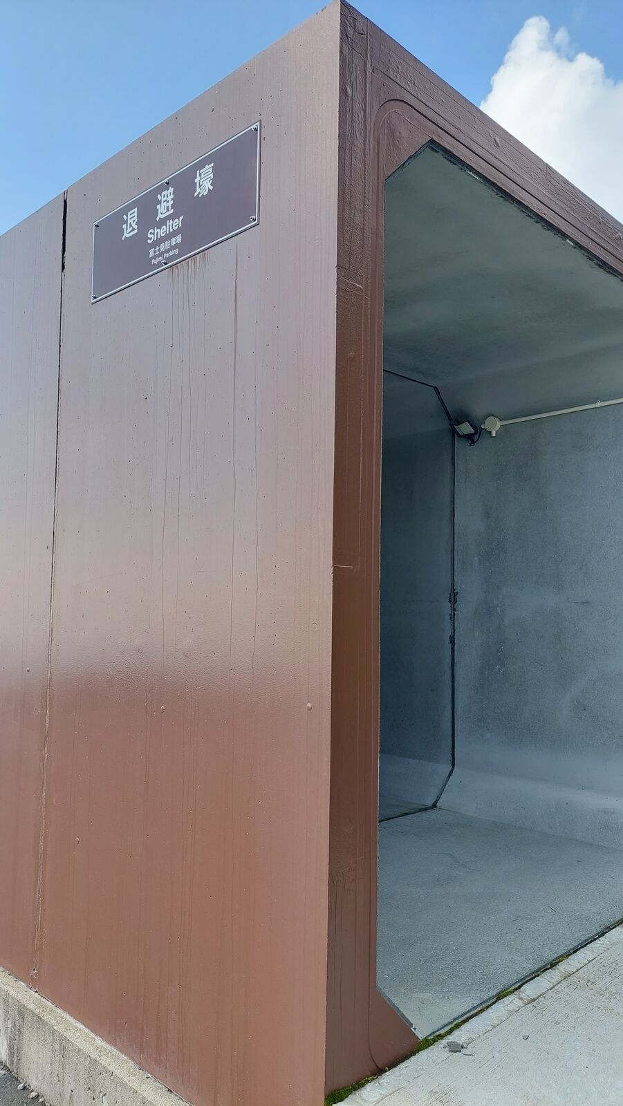
The road keeps reminding you that you're on the flank of an active volcano. Mount Kusatsu-Shirane (草津白根山) is not a theoretical risk. Signs warn about eruptions. Volcanic shelters line the roadside, brown metal and concrete structures designed to protect cars and people if the mountain decides to throw something. Further up, a large resthouse with a massive parking lot sits abandoned. Everything closed, fenced off. The building stands there like a relic from a time when tourists could walk up to the crater lake. Since the 2018 eruption, the exclusion zone keeps everyone at a distance, and the parking lot that once held tour buses is empty.
You can smell the volcano before you see the fumaroles. A faint sulfur note in the air that gets stronger as you climb. Then the steam becomes visible: wisps of white rising from the bare mountainside a few thousand meters away, drifting across slopes where nothing grows. It looks like something from Iceland, not Japan. The contrast with the lush green valleys below is striking. Within a few hundred meters of altitude, you go from dense forest to a landscape that looks like it could swallow everything.
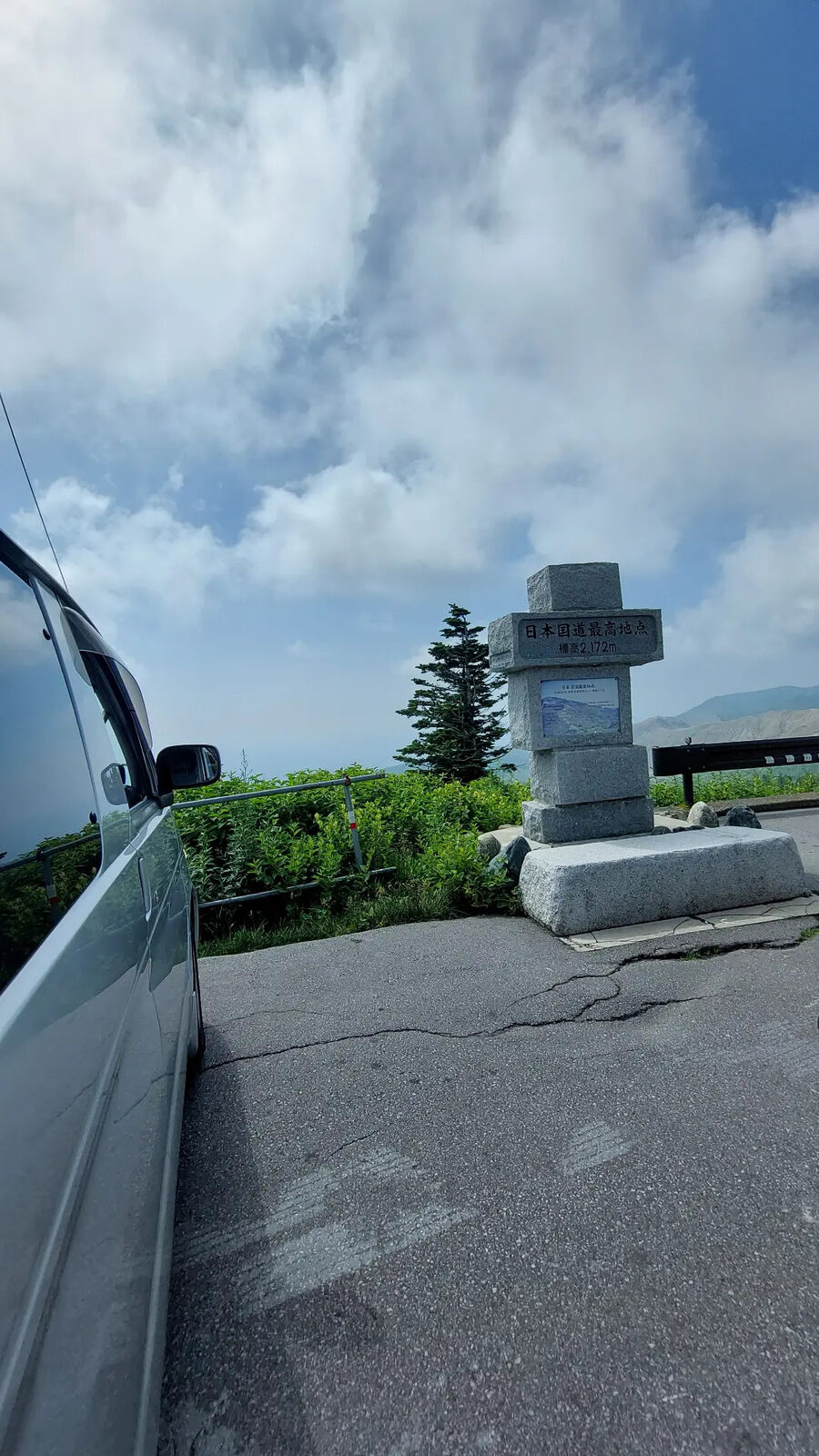
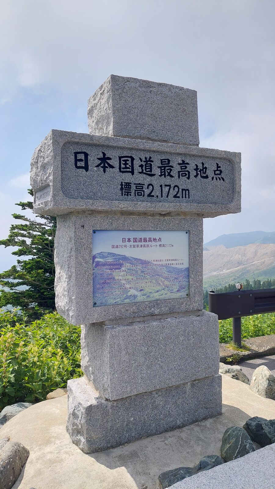
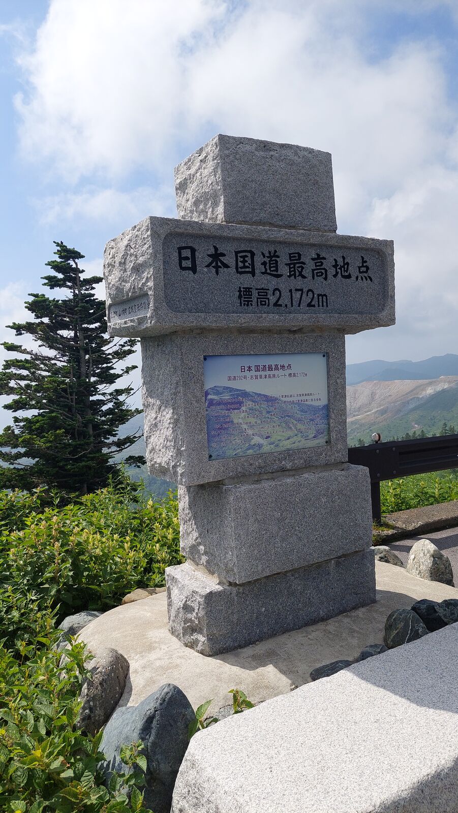
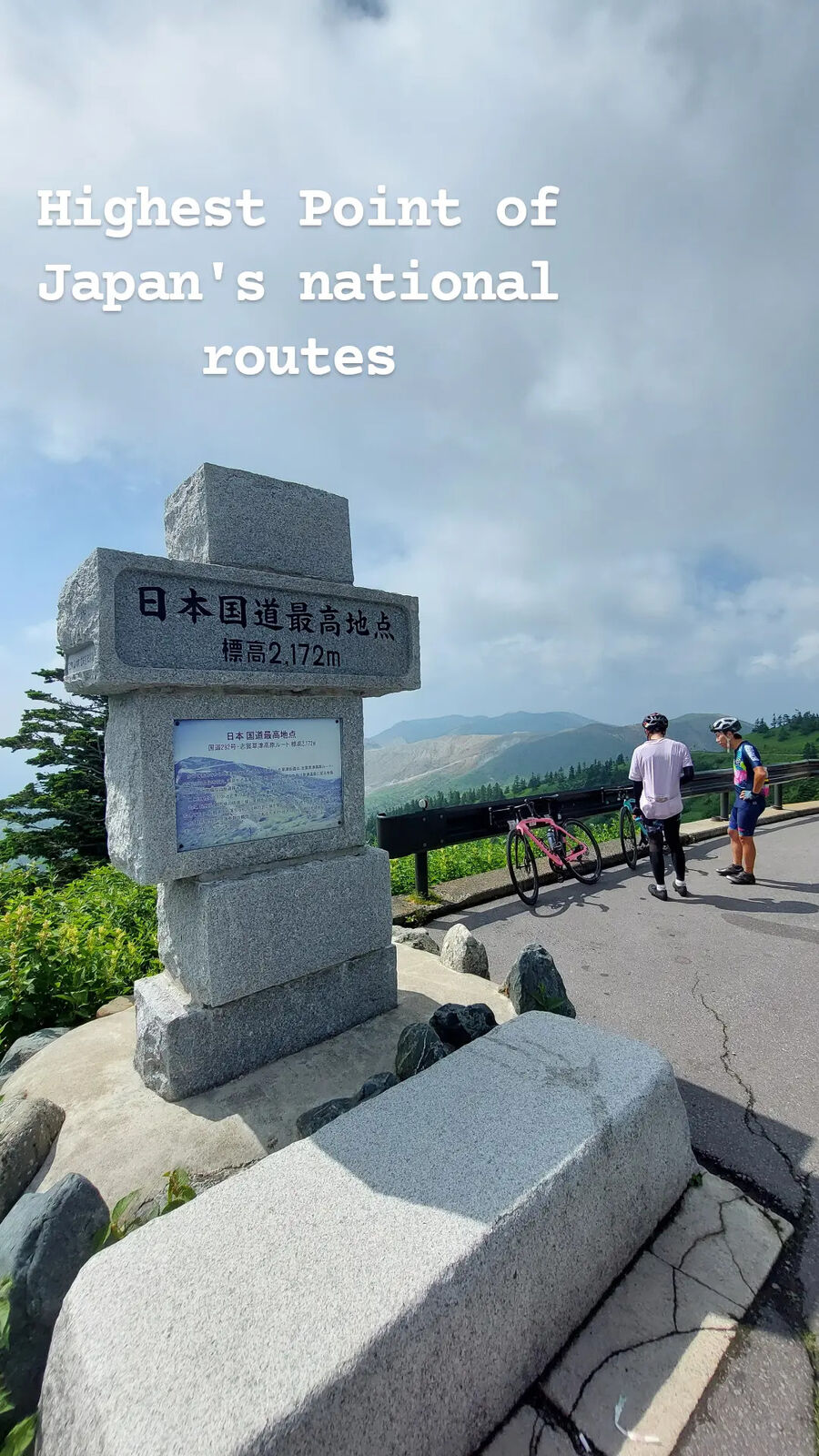
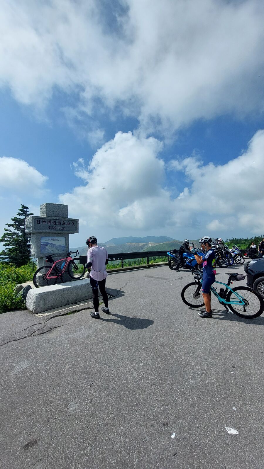
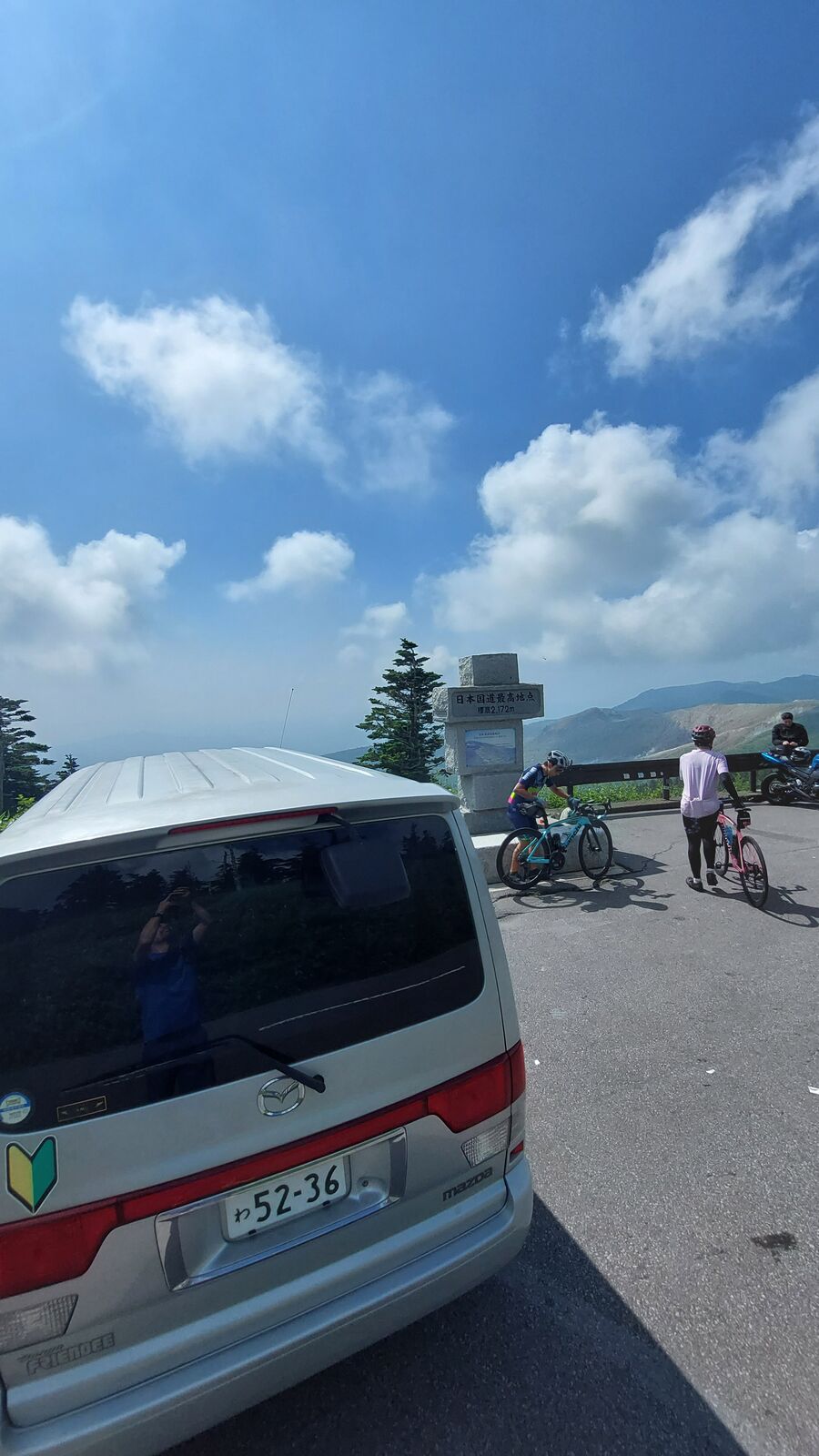
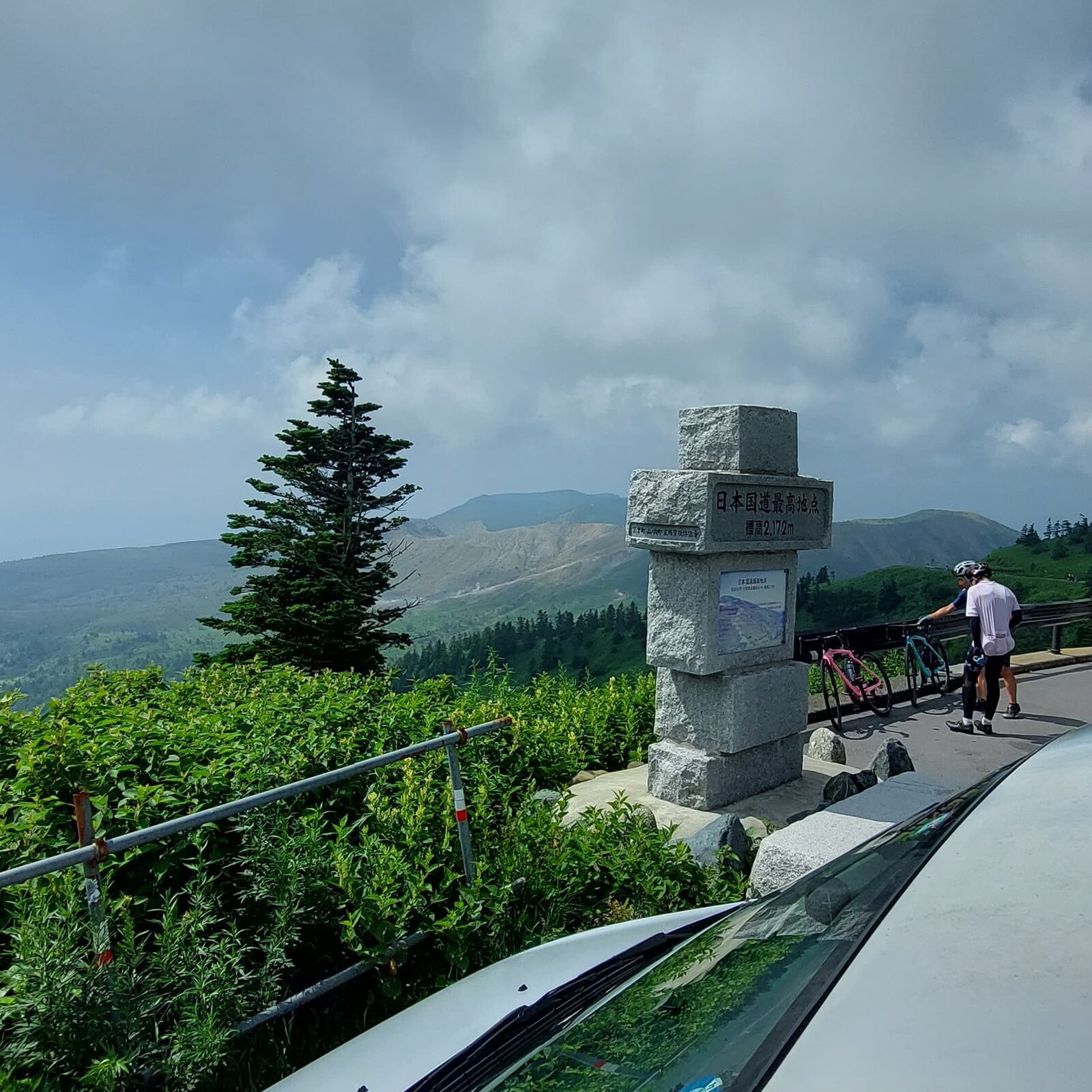
2,172 Meters
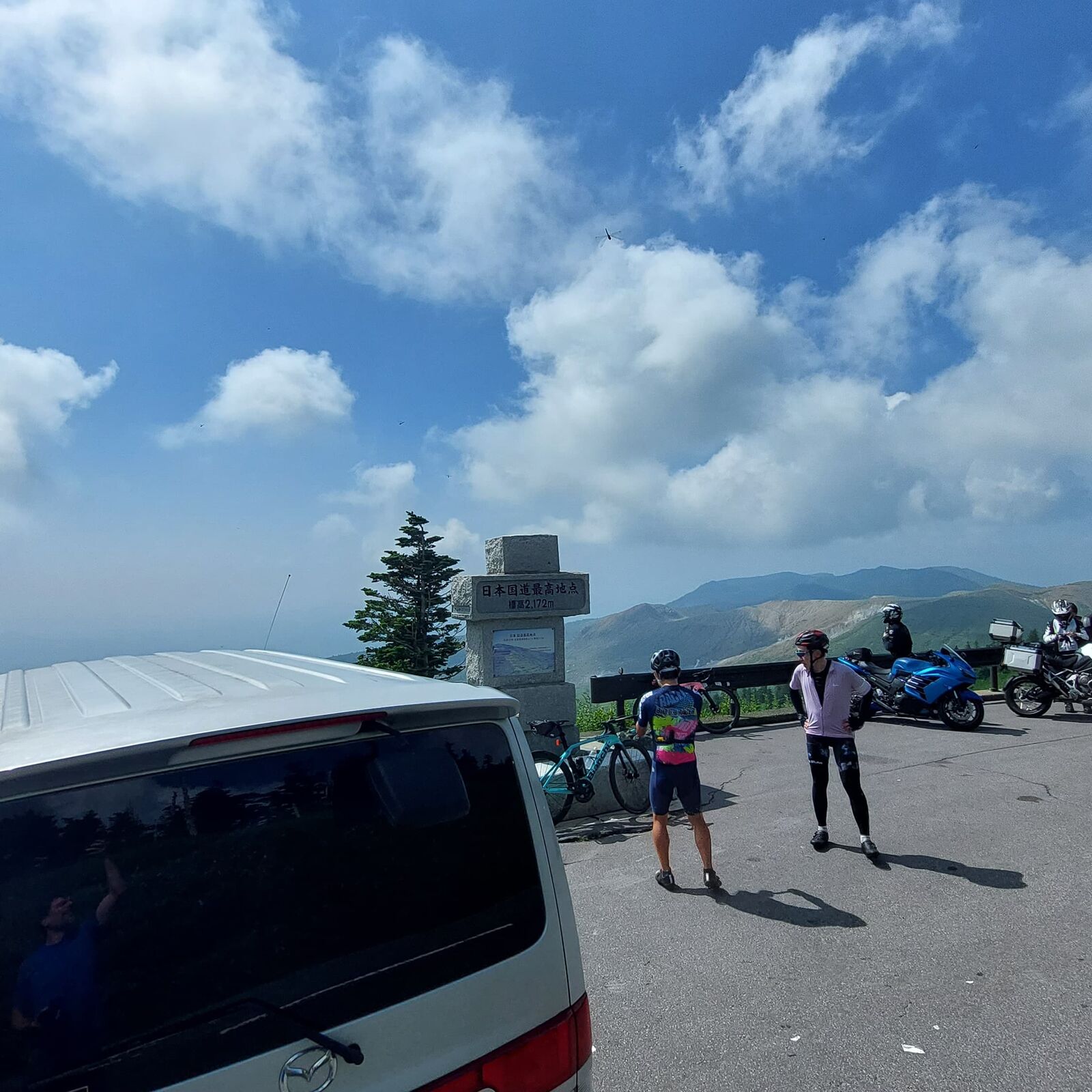
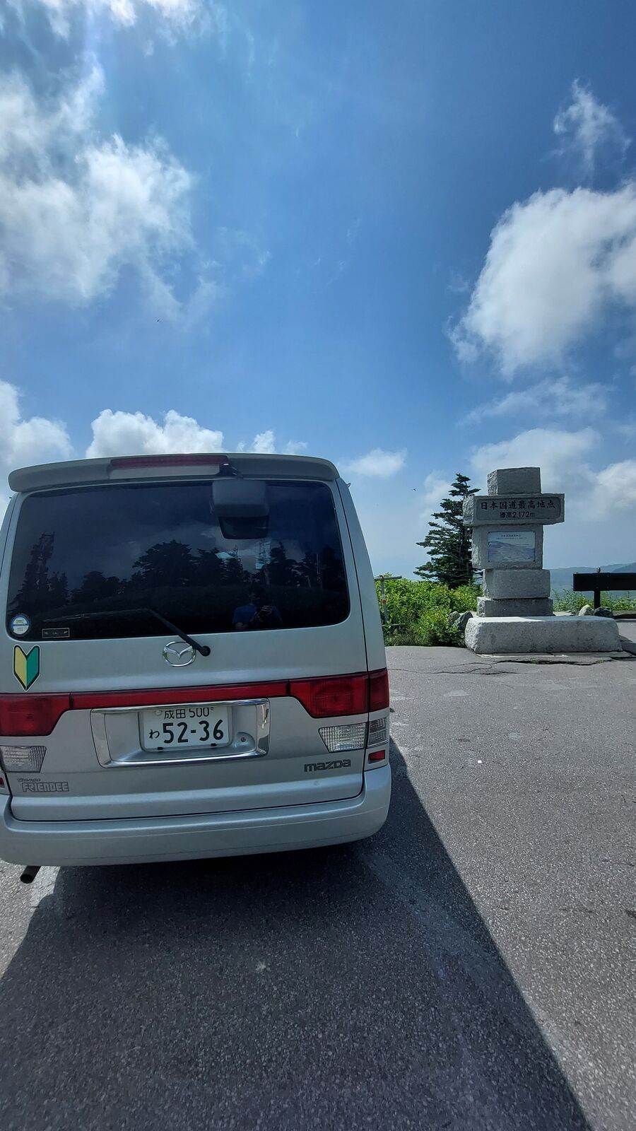
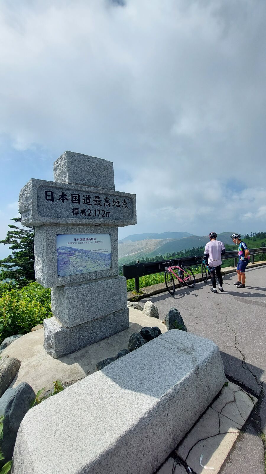
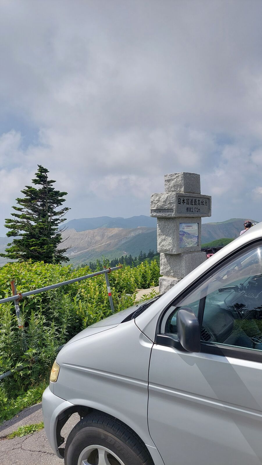
The highest point comes with a stone monument. A solid granite marker that reads 日本国道最高地点 - Highest Point of Japan's National Routes - with the elevation carved below: 2,172 meters. There's a pullover next to it, and when I arrived, it was busy. Cyclists catching their breath after the climb, leaning on their bikes and posing for photos. Motorcyclists pulling in, helmets under their arms. Cars stopping for a quick snapshot. This pass is a pilgrimage for road cyclists especially. The climb from either side is brutal, and the monument is their summit trophy.
I parked the van right next to the stone and got out. The air was thin and cool even in late July, maybe 25 degrees. After weeks of lowland heat, it felt like stepping into a different season. Clouds drifted at eye level. From up here you could see Mount Kusatsu-Shirane's volcanic slopes with their sulfur steam, and in the other direction, the road snaking down into Nagano's forested valleys. The parking area had a constant turnover of people. Someone arrived, took their photo, left. Someone else pulled in. It felt like a shared moment, strangers acknowledging the same thing: higher than this, no road in Japan goes.
Eagles and Switchbacks
On the way down toward Nagano, I passed a cluster of birdwatchers stationed at a viewpoint. Serious equipment. Telephoto lenses the size of artillery barrels mounted on tripods, all pointed at the same patch of sky. Somewhere up on the cliff, a raptor's nest. I stopped and tried to photograph whatever they were watching with my own camera, but without a 600mm lens, I had no chance. The birdwatchers didn't seem to mind the company. They'd found their spot and weren't leaving.
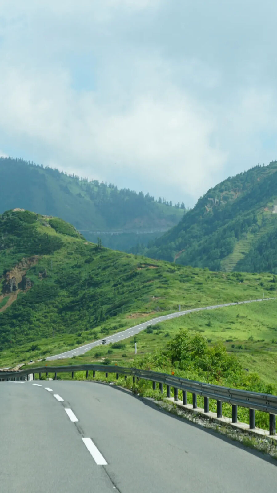
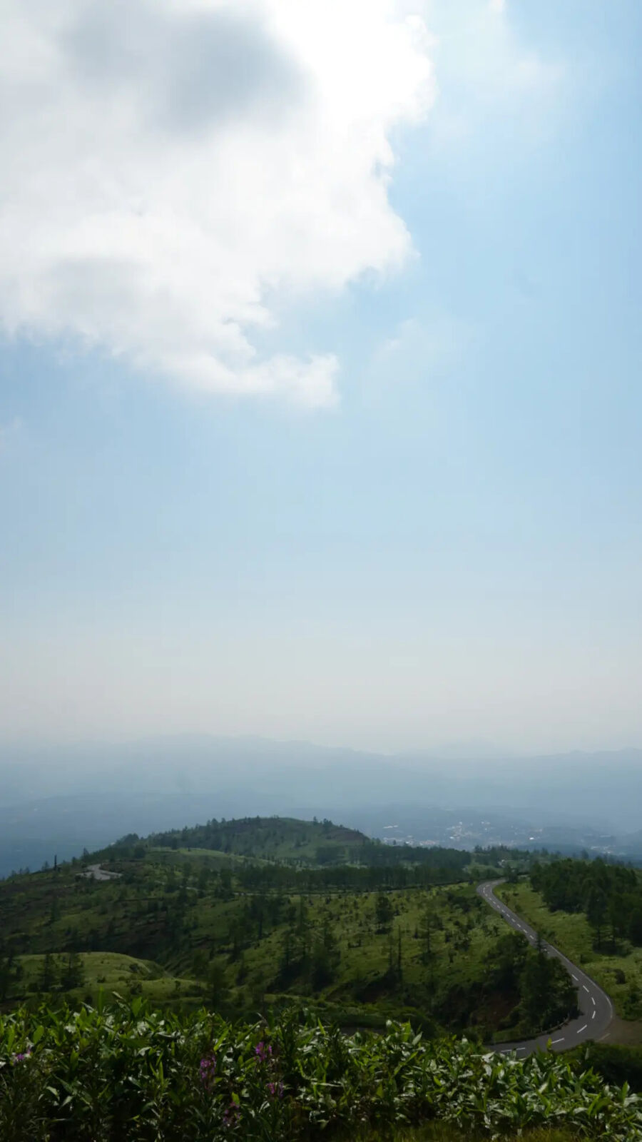
The switchbacks on the descent are where the road shows its character. Long sweeping curves through green alpine slopes, guardrails on one side, mountains on the other. Motorcyclists love this section. You share the road with sports bikes leaning into corners and touring riders taking it slow. The surface is excellent, the views change with every turn, and the traffic is just enough to keep it interesting without feeling crowded. Like the White Road, this is one of those drives where you don't want it to end. The road is the destination, and the destination keeps going.
Practical Info
Route: National Route 292 connects Kusatsu Onsen (Gunma) with Shiga Kogen / Yamanouchi (Nagano). The scenic section is the Shiga-Kusatsu Road (志賀草津道路), roughly 45 km. No toll.
Season: Open from late April to mid-November. In spring (late April to early May), snow walls up to 5-8 meters line the road. Closed in winter.
Volcanic alerts: Mount Kusatsu-Shirane is an active volcano. Sections of Route 292 near Yugama crater may be restricted when the alert level is raised. Check current conditions before driving. The Kusatsu-Shirane Resthouse and surrounding area have been closed since October 2022.
Highest point: 2,172 meters at Shibu Pass (渋峠), on the border between Gunma and Nagano prefectures. Stone monument and small parking area on the roadside. View on Google Maps
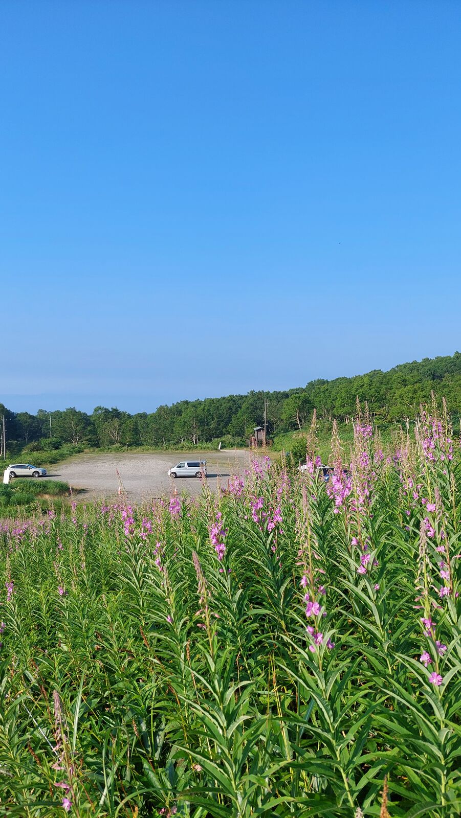
Tip: Start early from the Gunma side for morning light on the volcanic terrain. The pass is popular with cyclists and motorcyclists on weekends. If camping nearby, Lake Nozori in northern Gunma makes a quiet overnight spot before the drive.
Summer heat escape: At 2,172 meters, temperatures are 10-15 degrees cooler than the valleys below. In mid-summer when lowland Japan hits 35-40 degrees, the pass sits around 20-25. Worth the drive for the air alone.