Mount Aso is one of those places that doesn't look like Japan. It doesn't look like anywhere on Earth, really. You drive up through green Kyushu farmland and forests, and then at some point the trees stop and the ground turns grey and the air smells different and you're standing on what feels like the surface of the moon. Except the moon doesn't have a crater actively pumping out volcanic gas a few hundred meters from where you're standing.
Aso is the largest active volcano in Japan, sitting inside one of the biggest calderas in the world. The caldera itself is 25 kilometers across, and about 50,000 people live inside it, farming rice and raising cattle on some of the most fertile volcanic soil in the country. The active crater, Nakadake, is just one of five peaks along the caldera's central ridge. It's the one that's still alive.
The Crater
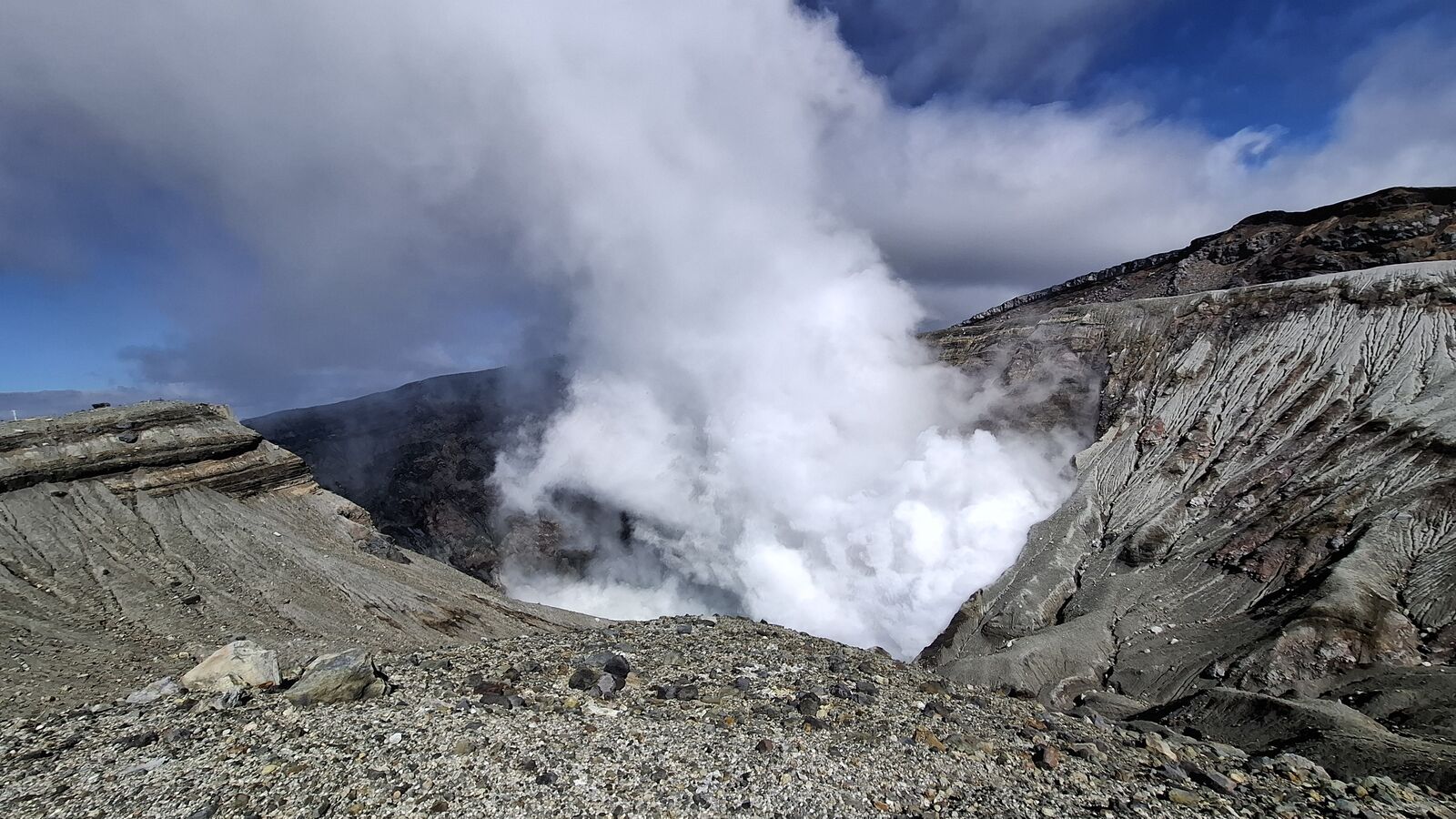
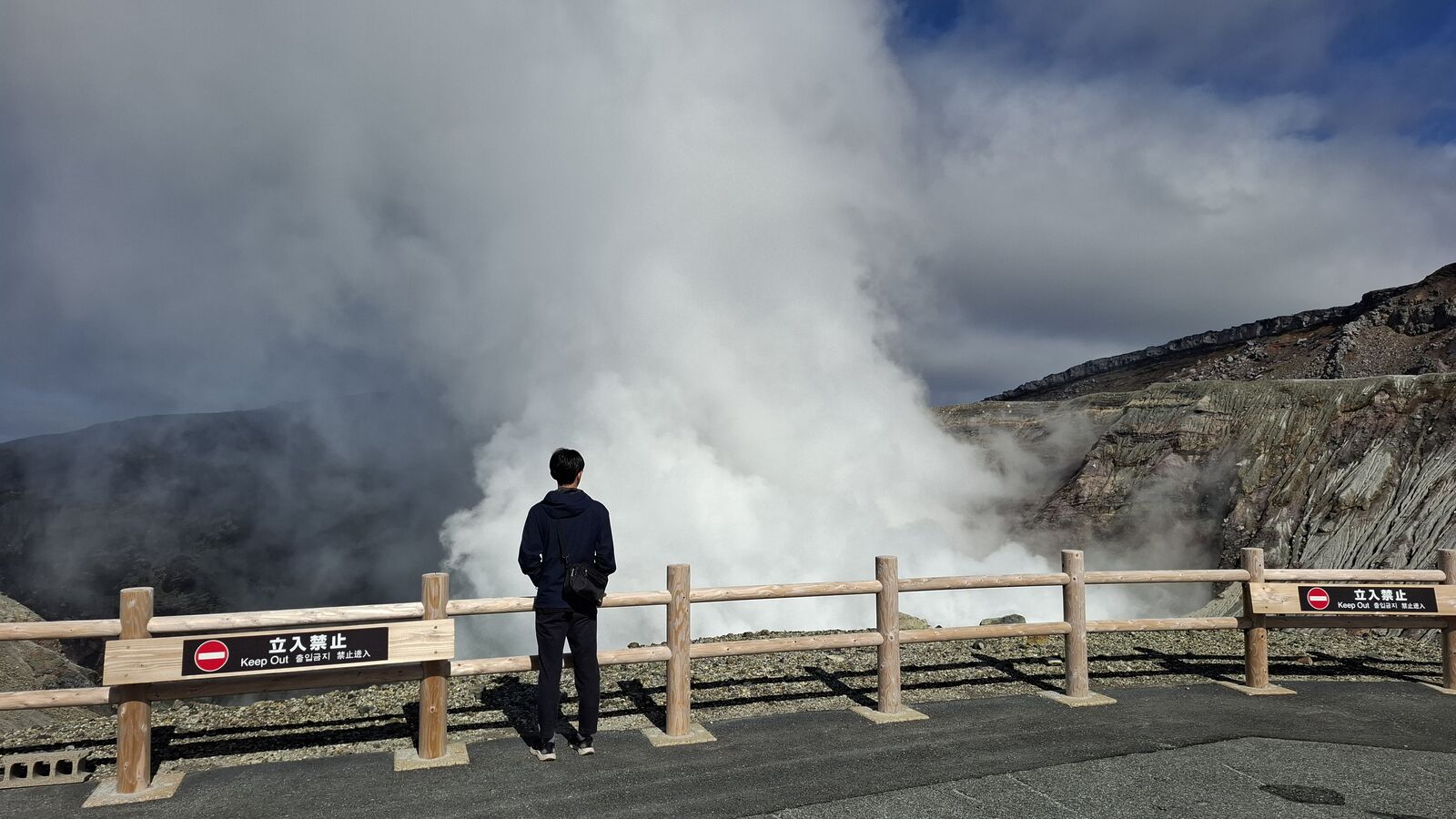
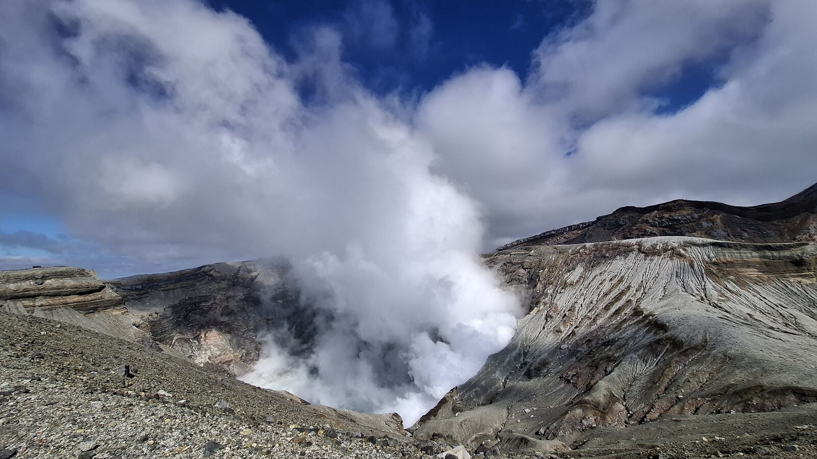
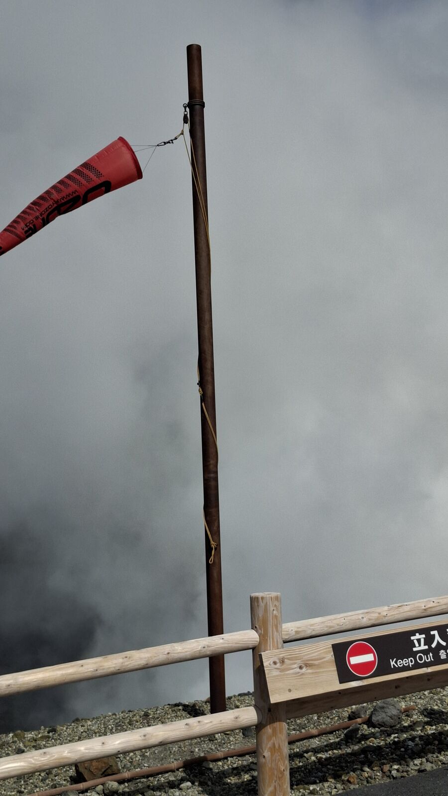
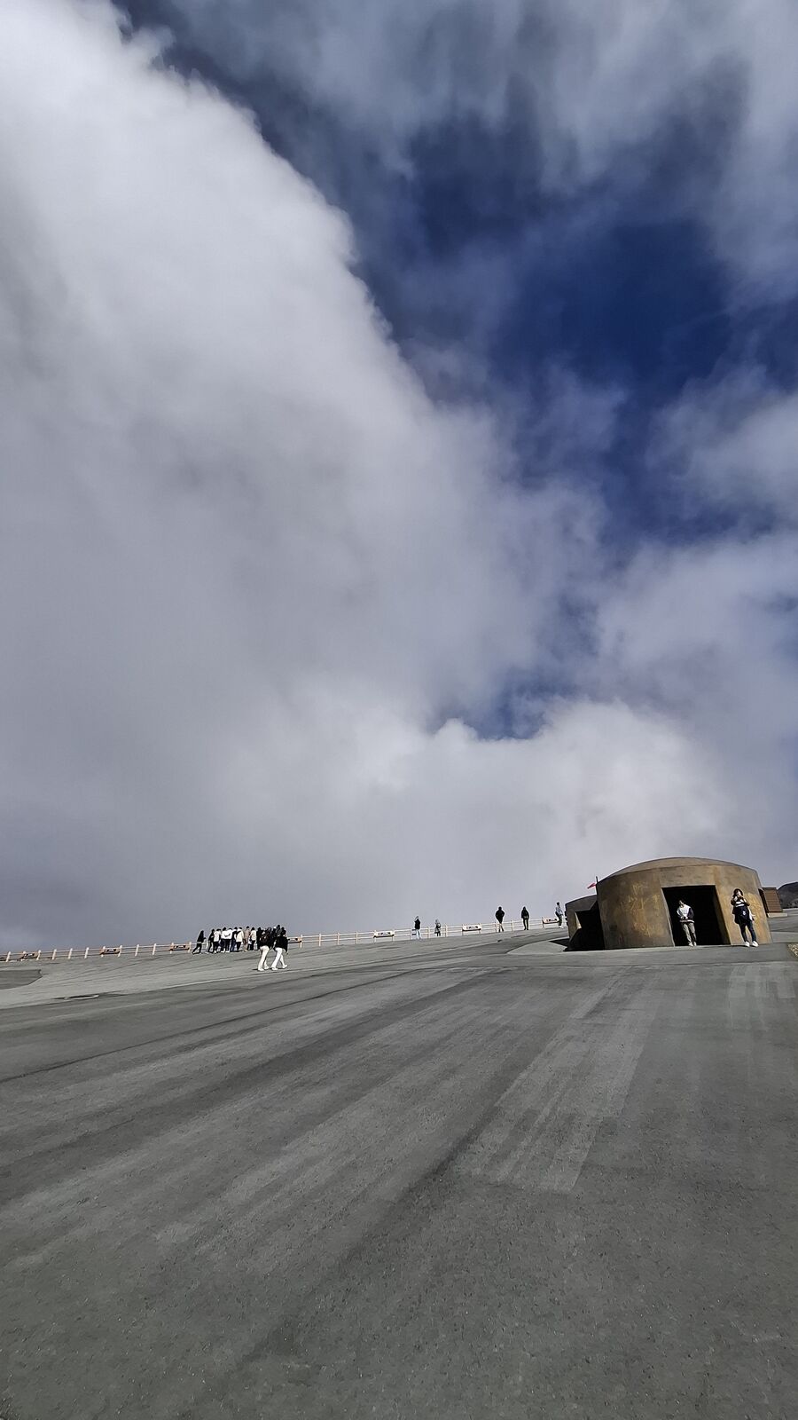
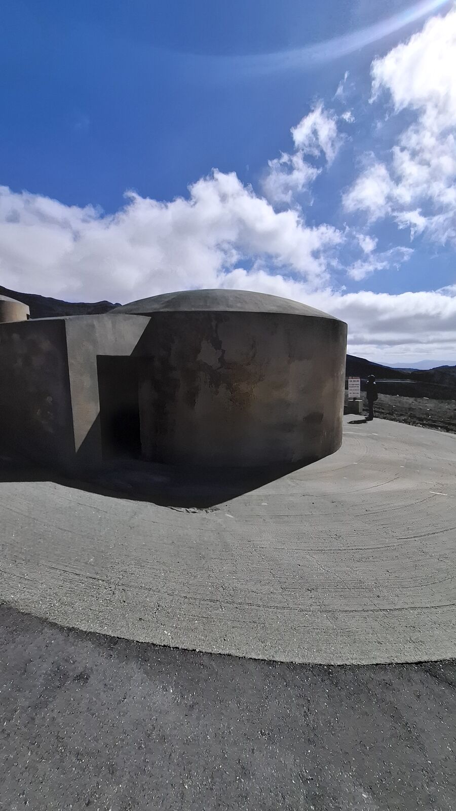
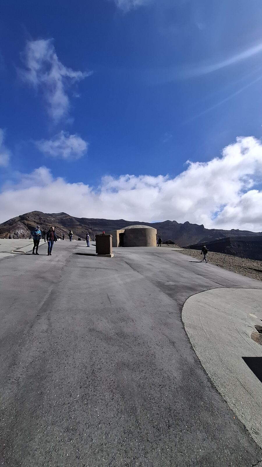
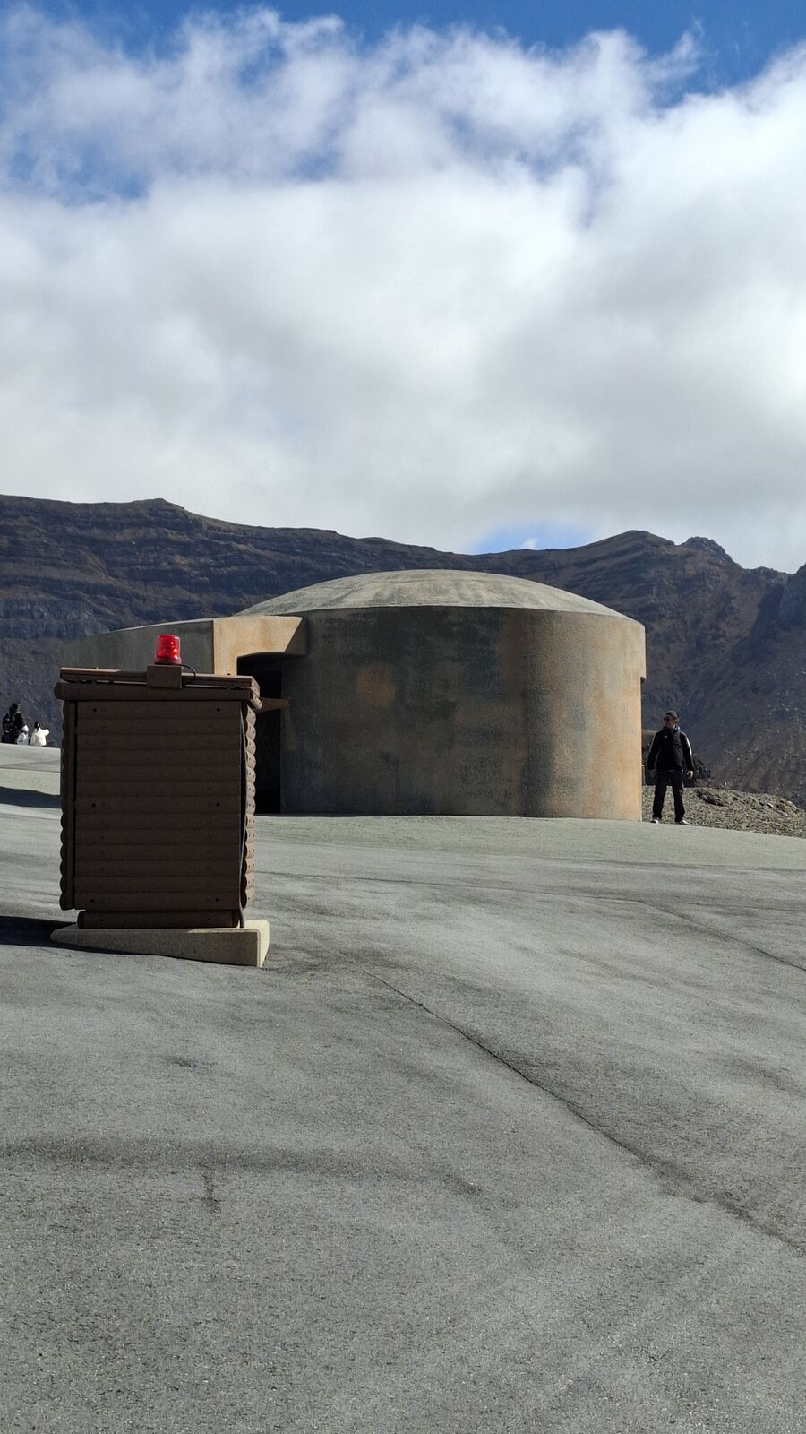
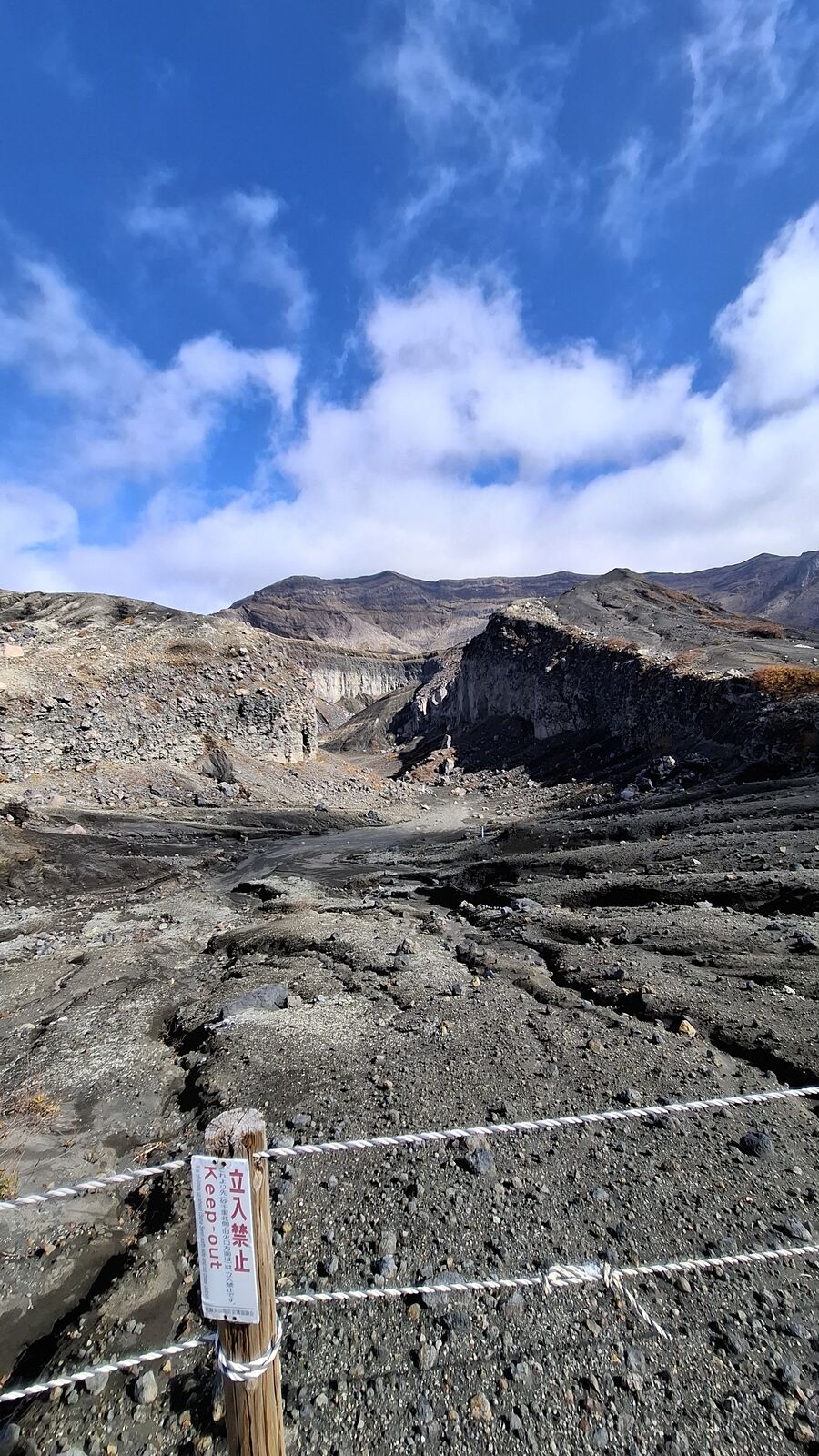
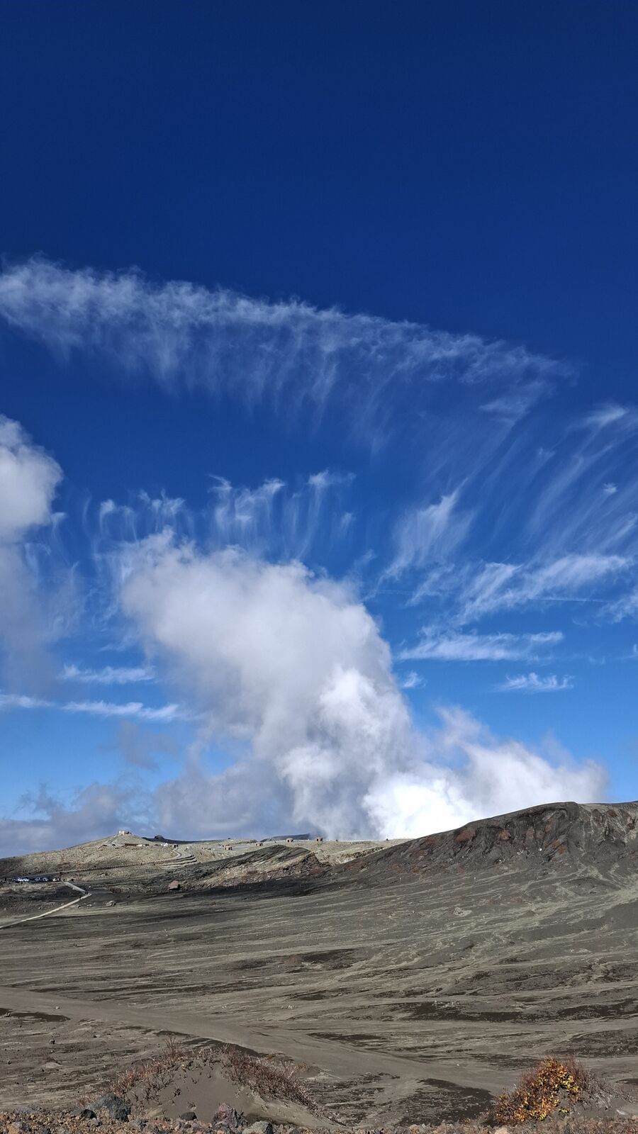
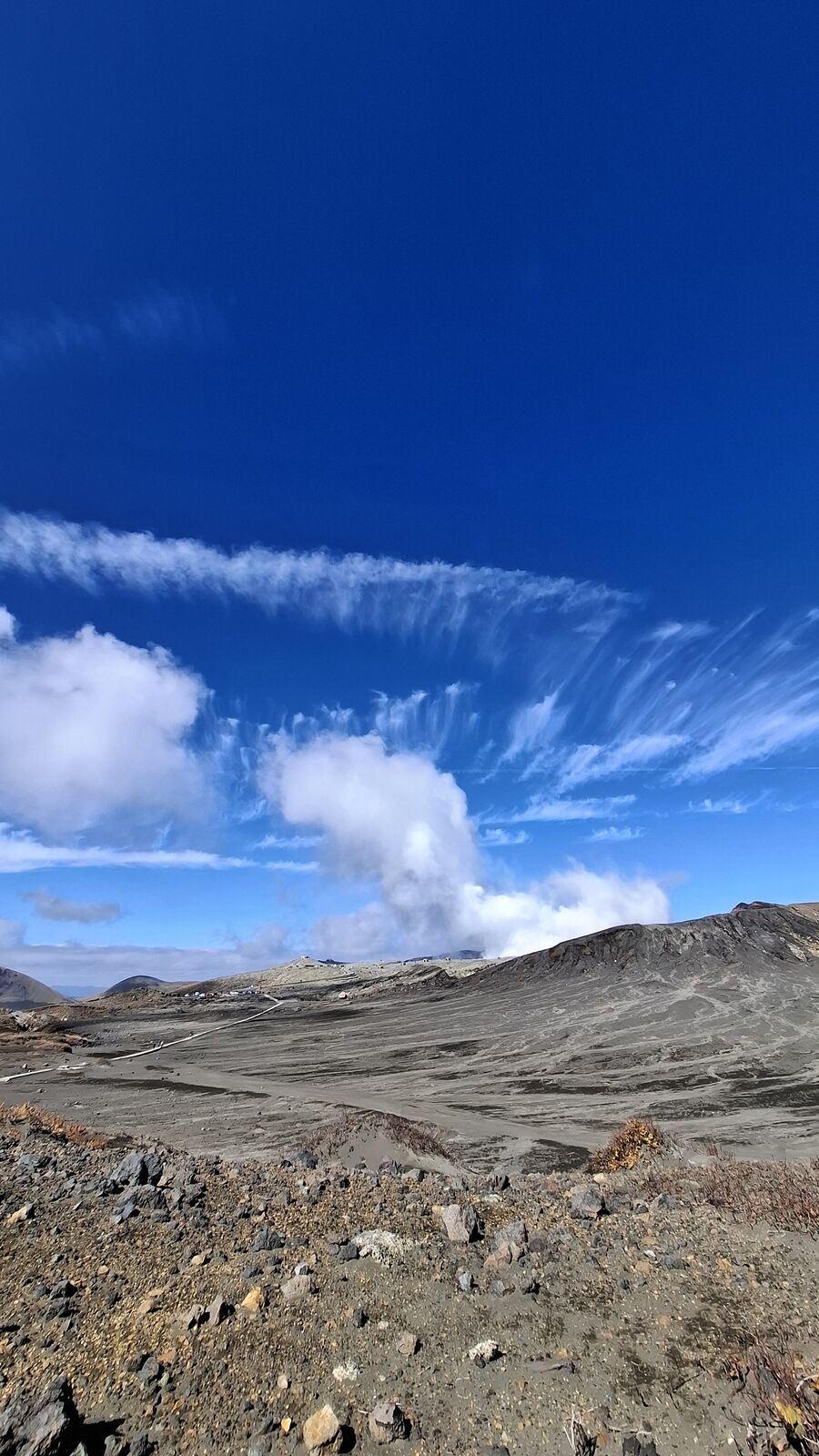
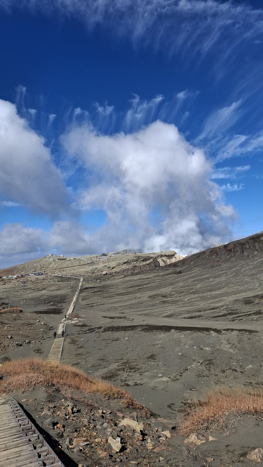
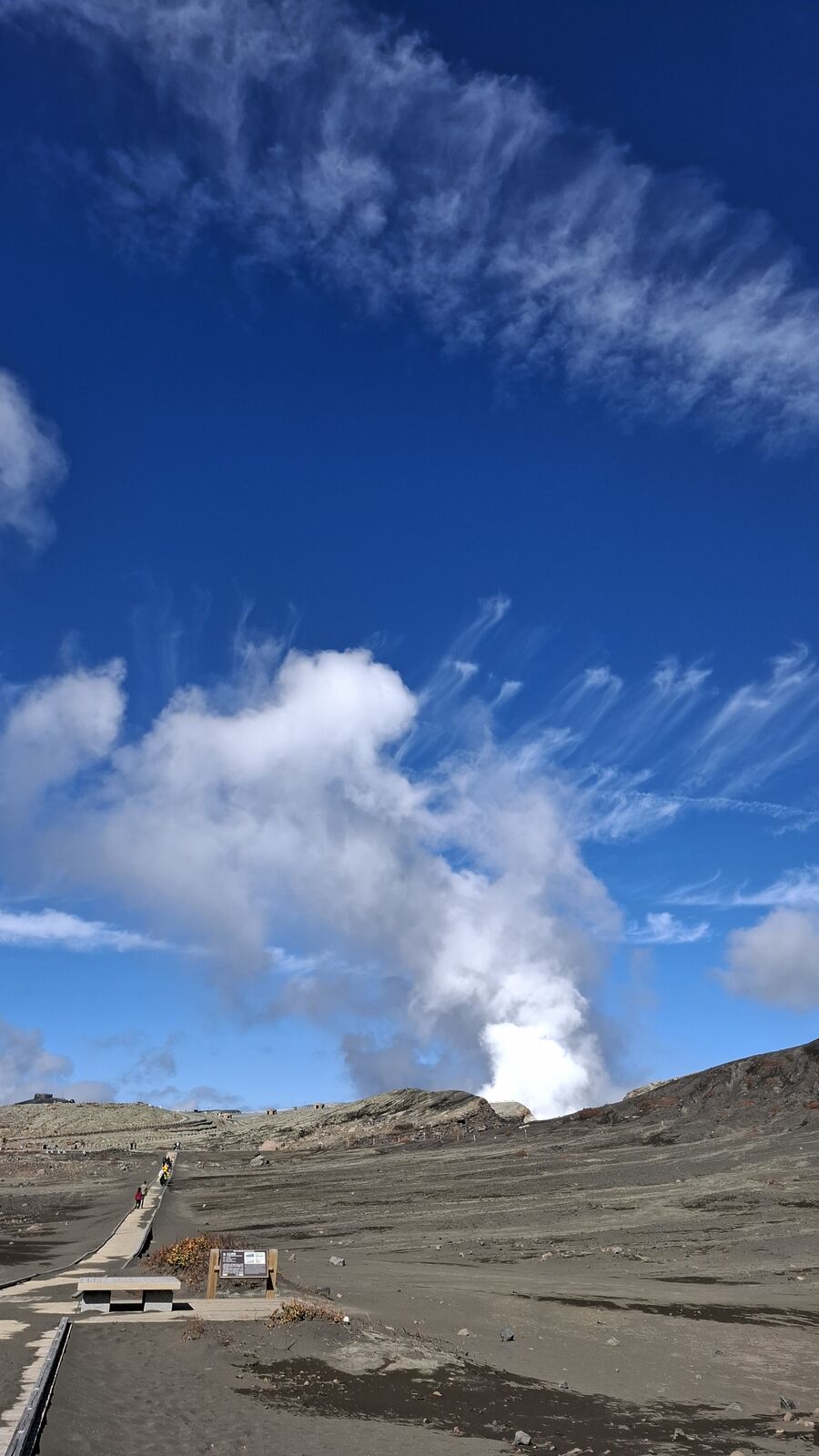
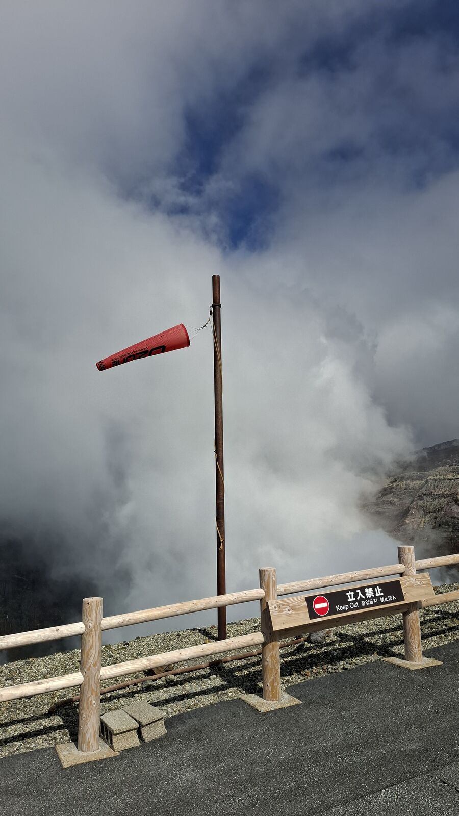
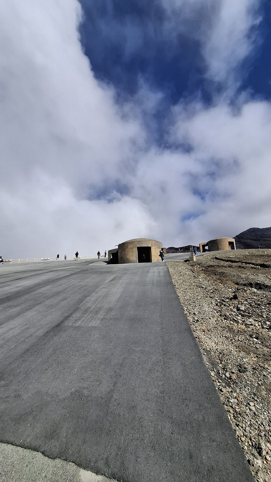
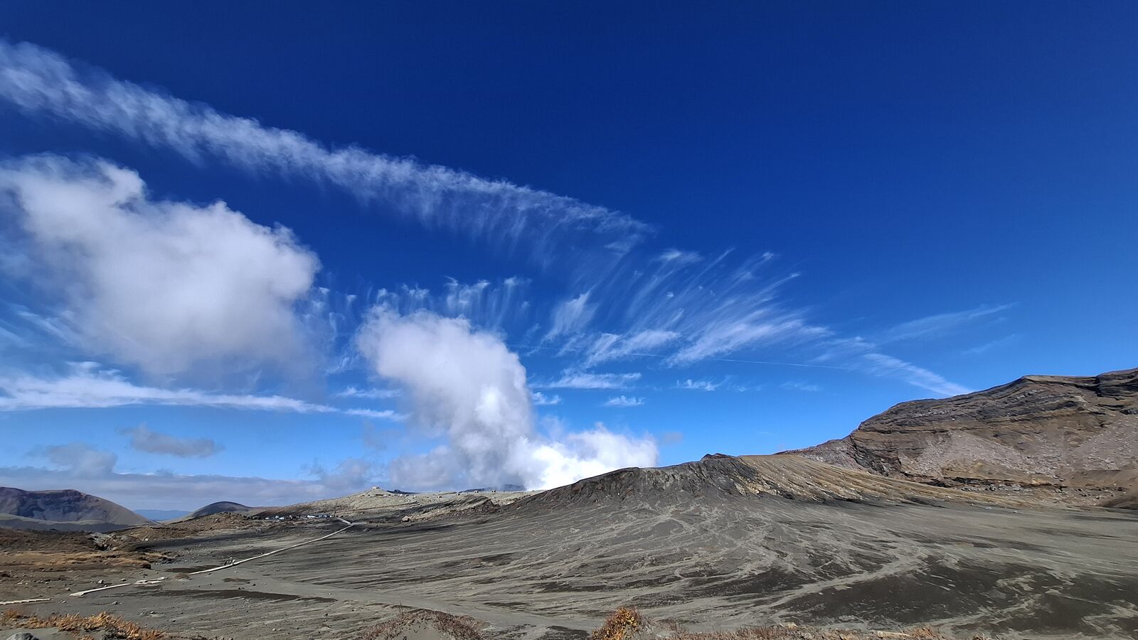
You can drive almost all the way up to Nakadake. There's a parking lot and a paved path, and then you're standing at a railing looking into an active volcanic crater. The first thing that hits you is the scale. The crater walls drop away in layers of grey and brown and rust-colored rock, striped like geological sediment, and from the bottom a column of white steam rises with a force that makes your chest vibrate. It's not gentle steam. It's pressurized, violent, loud in a way you feel more than hear. The wind shifts it constantly, and when it blows toward you, you understand immediately why there are gas monitors and windsocks and evacuation shelters built along the path.
I had never been this close to an active volcano. I've seen Sakurajima from across the bay, watched Etna smoke from a distance in Sicily. But standing at the railing at Nakadake, close enough that the steam blocks out the sky, is different. The "Keep Out" signs aren't decorative. The concrete bunkers along the walkway aren't historical. They're there because this mountain killed people as recently as 2021, and the gas levels can change in minutes.
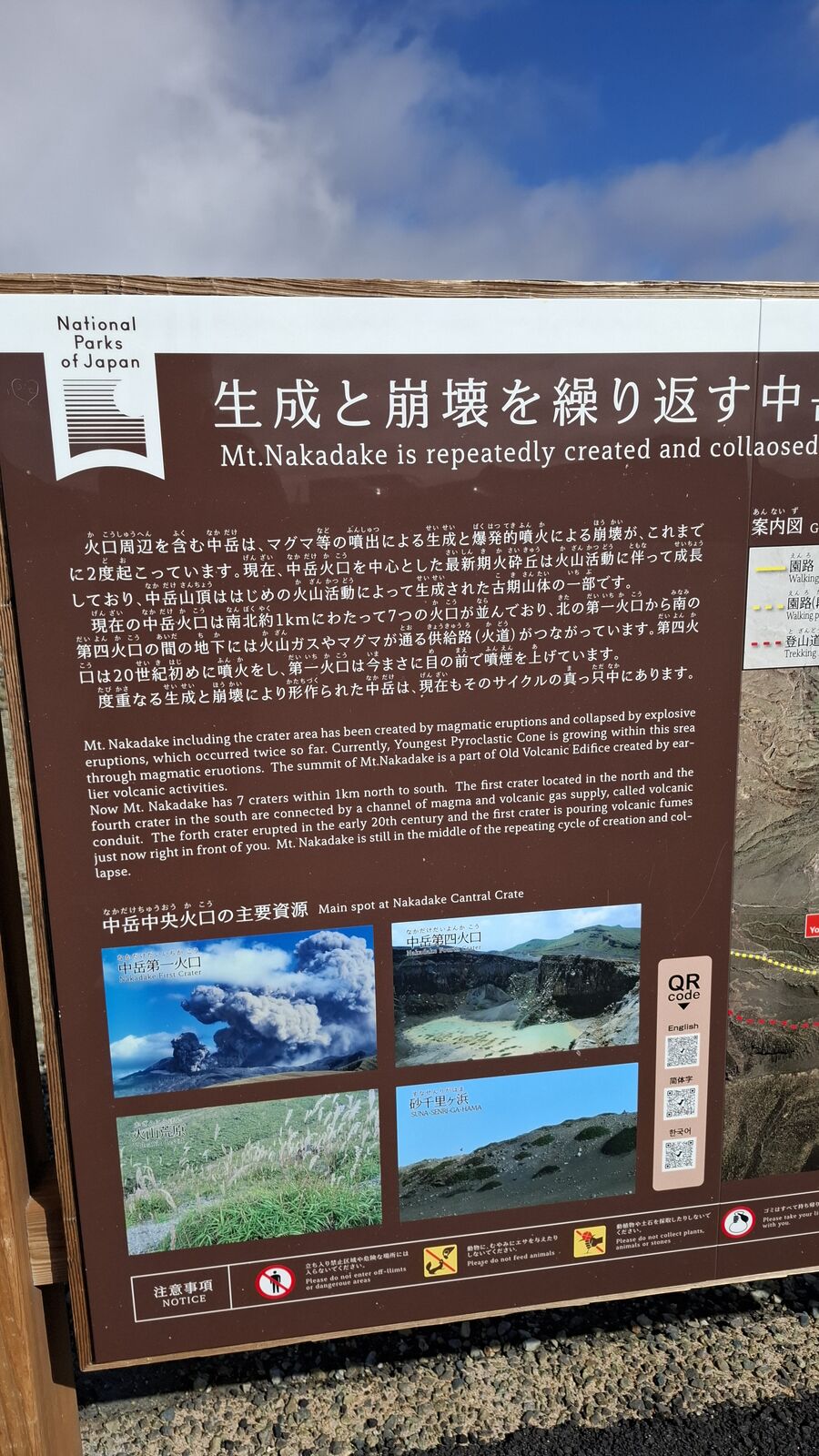
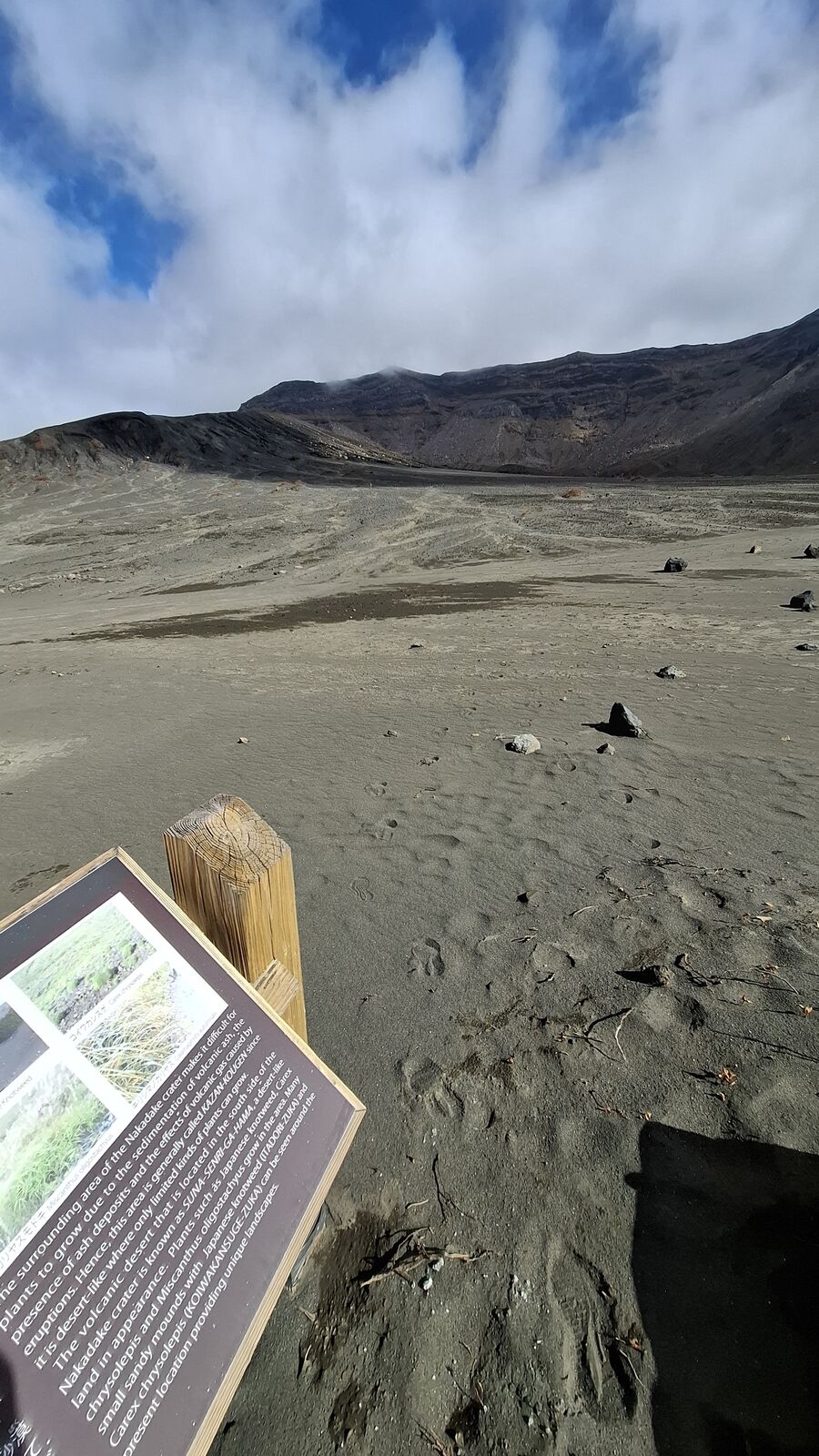
An information board near the crater explains that Nakadake has repeatedly created and collapsed throughout its history. It builds itself up, erupts, destroys itself, and starts again. There's something honest about a mountain that keeps doing the same thing over and over, without pretending it's finished.
The Moonscape
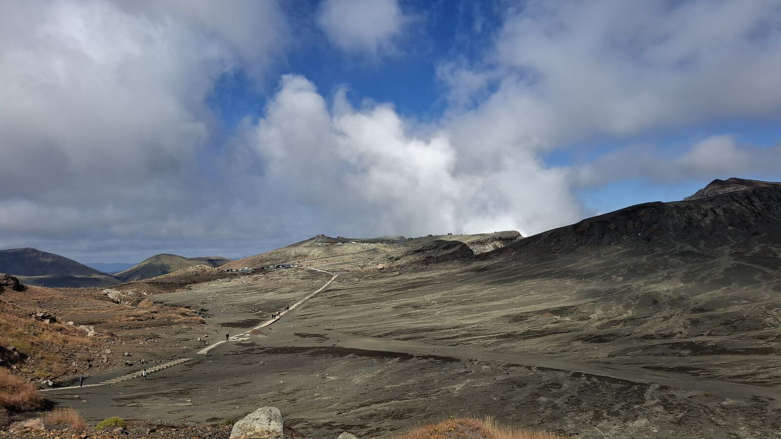
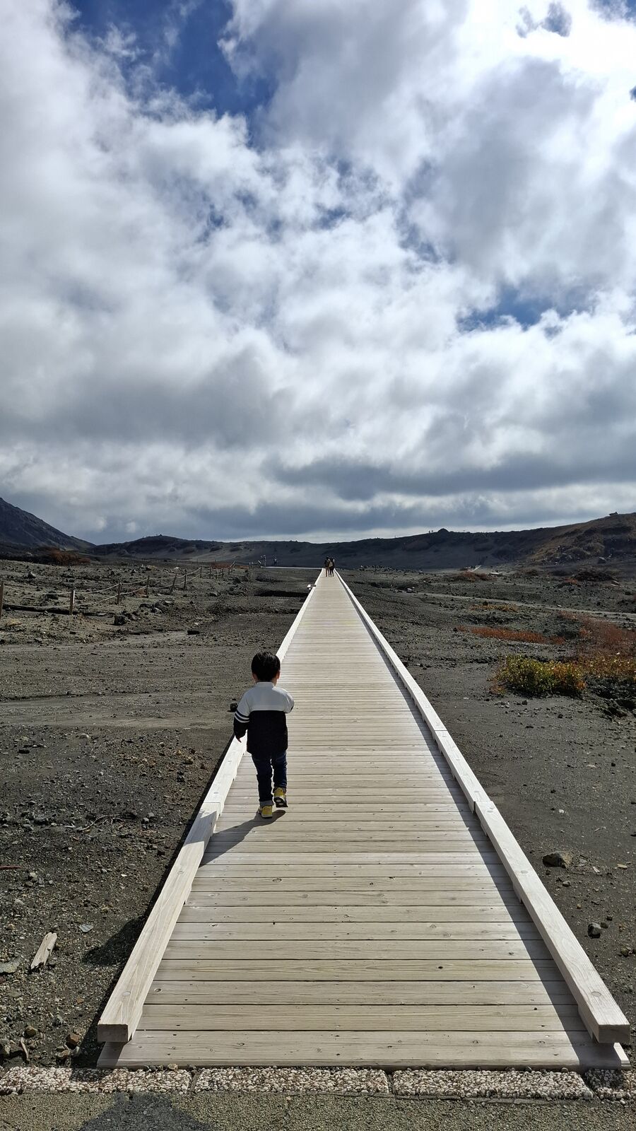
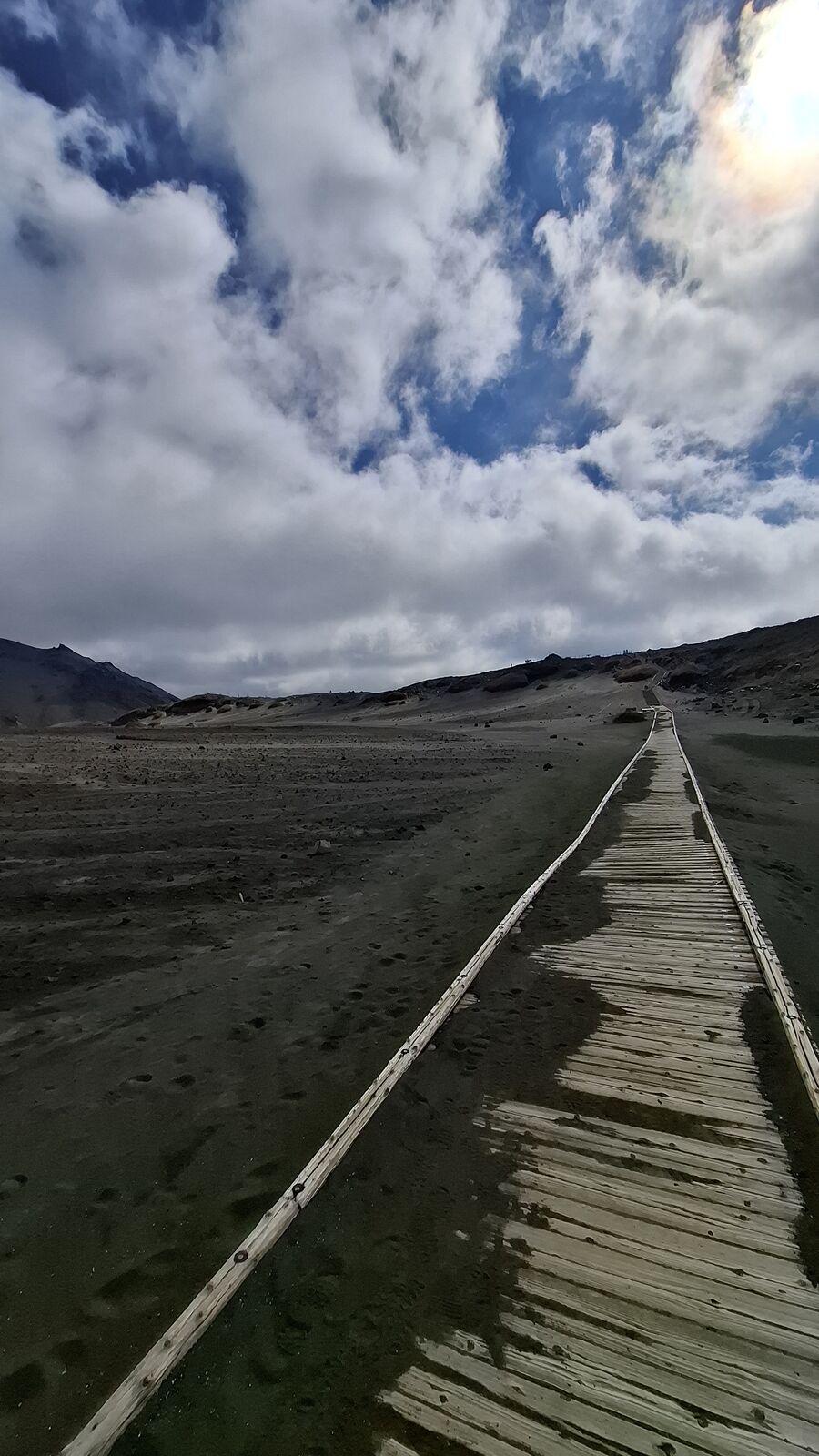
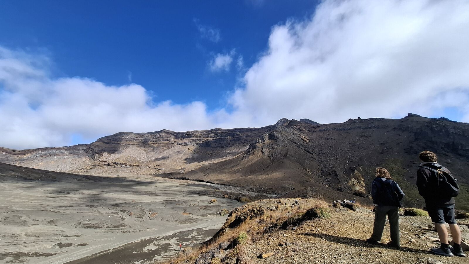
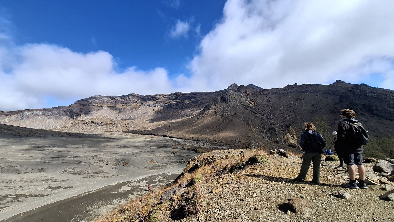
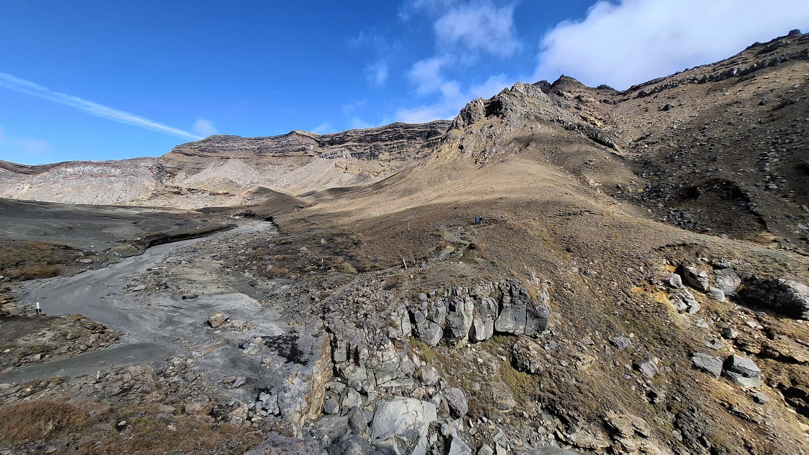
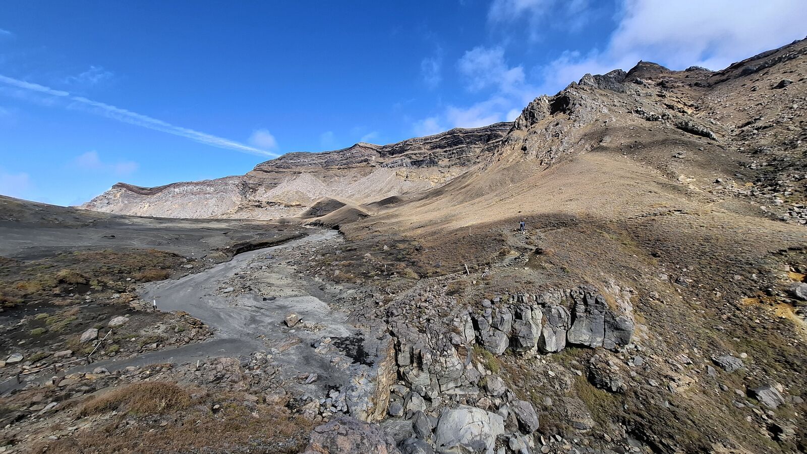
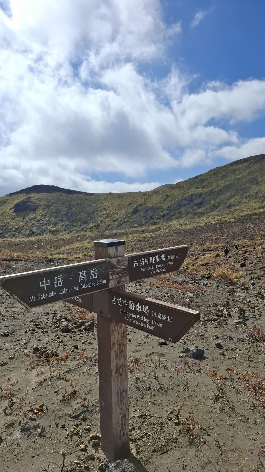
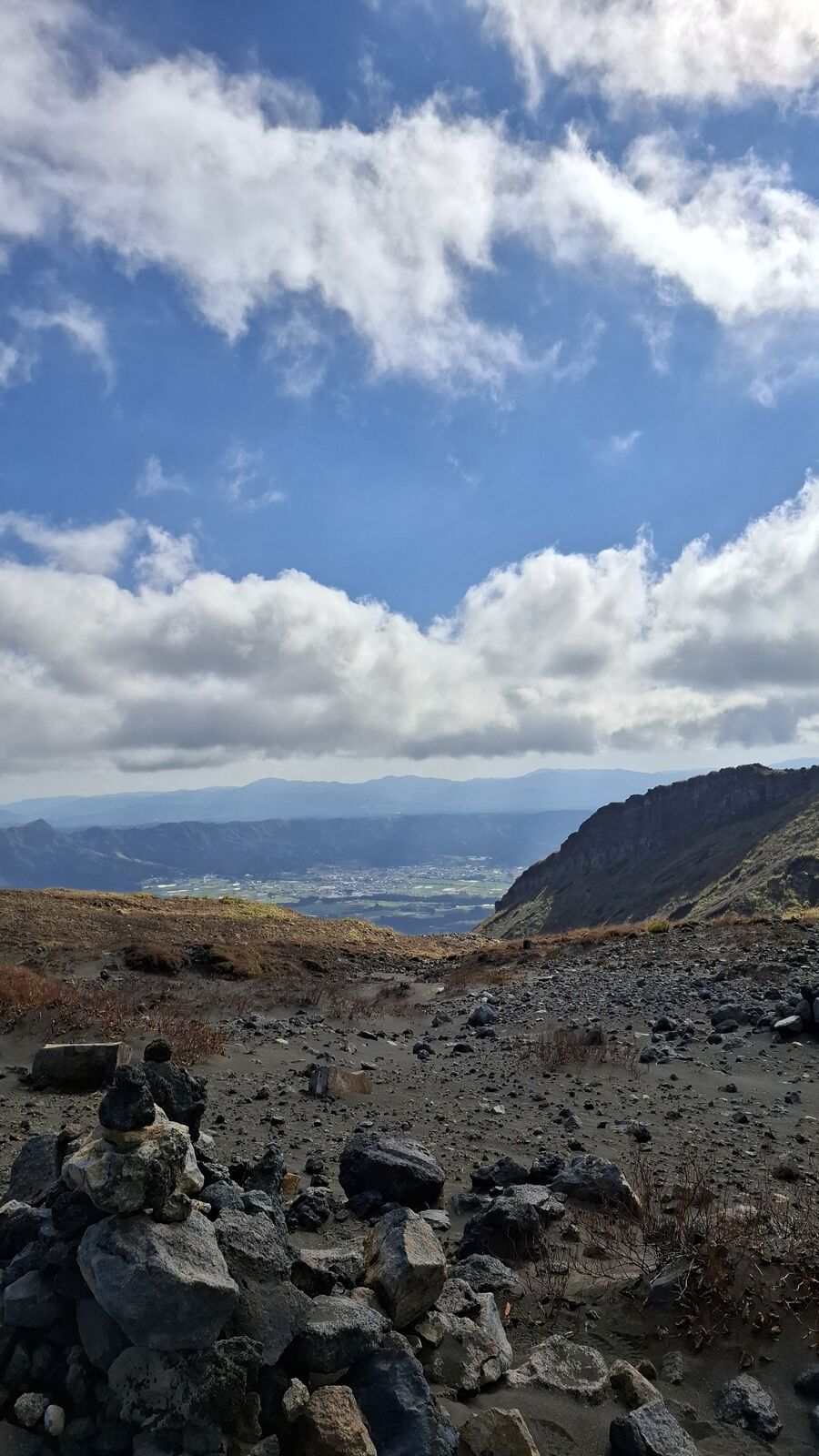
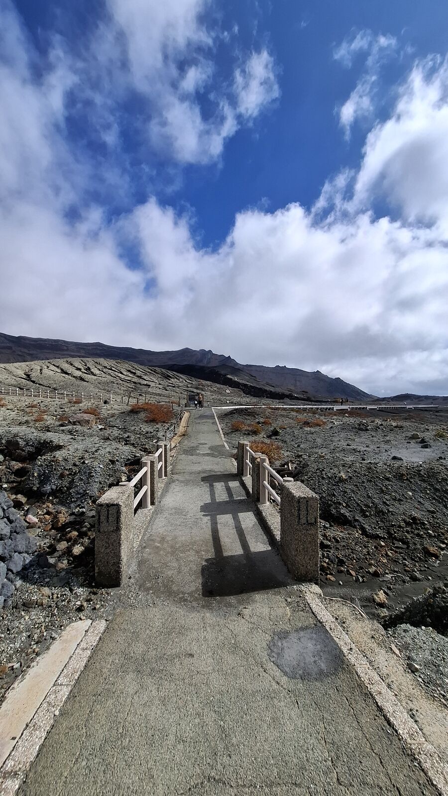
Past the crater viewpoint, the landscape opens up into something that looks like it belongs on another planet. Grey volcanic ash and rock stretch in every direction. There's no vegetation, no color, just the geometry of erosion and the distant ridgeline of the caldera wall. A boardwalk path leads across this desert, and if you follow it far enough, you leave the other visitors behind and find yourself alone in a landscape that predates everything human.
I hiked out across the volcanic plain, past direction signs pointing toward Mt. Nakadake and Mt. Takadake, past rock formations that looked like they'd been carved by wind and acid rain. The further I went, the quieter it got. There were other people near the crater, plenty of them, but out here on the plain it was just me and the sky and the constant faint rumble of the mountain doing what mountains do.
I ran into a German woman out on the trail. She worked for a Japanese company, close to retirement, and was using the time to do a proper tour of Kyushu. We talked for a while about the places we'd seen and the ones we were heading to. Weeks later, I'd run into her again at Sengan-en near Sakurajima. Kyushu is a big island, but the people traveling it on their own seem to end up in the same places.
The Evacuation
When I got back to the parking lot, something had changed. Cars were leaving. People were moving quickly, not panicking but not lingering either. Then one of the officials approached and told me that elevated gas levels had been measured and the crater area was being evacuated.
Nothing dramatic happened. No explosion, no visible change. Just instruments detecting what human noses can't, and a system responding exactly as it should. But it was a reminder that Aso is not a museum. It's an active volcano with a monitoring infrastructure built from hard experience. The bunkers, the windsocks, the gas detectors, the evacuation protocols. None of it is theoretical. People have died here, and the mountain hasn't stopped being dangerous just because there's a parking lot and a gift shop.
I'd timed it perfectly without knowing. Another hour up there and the evacuation would have been less comfortable.
A Sea of Grass
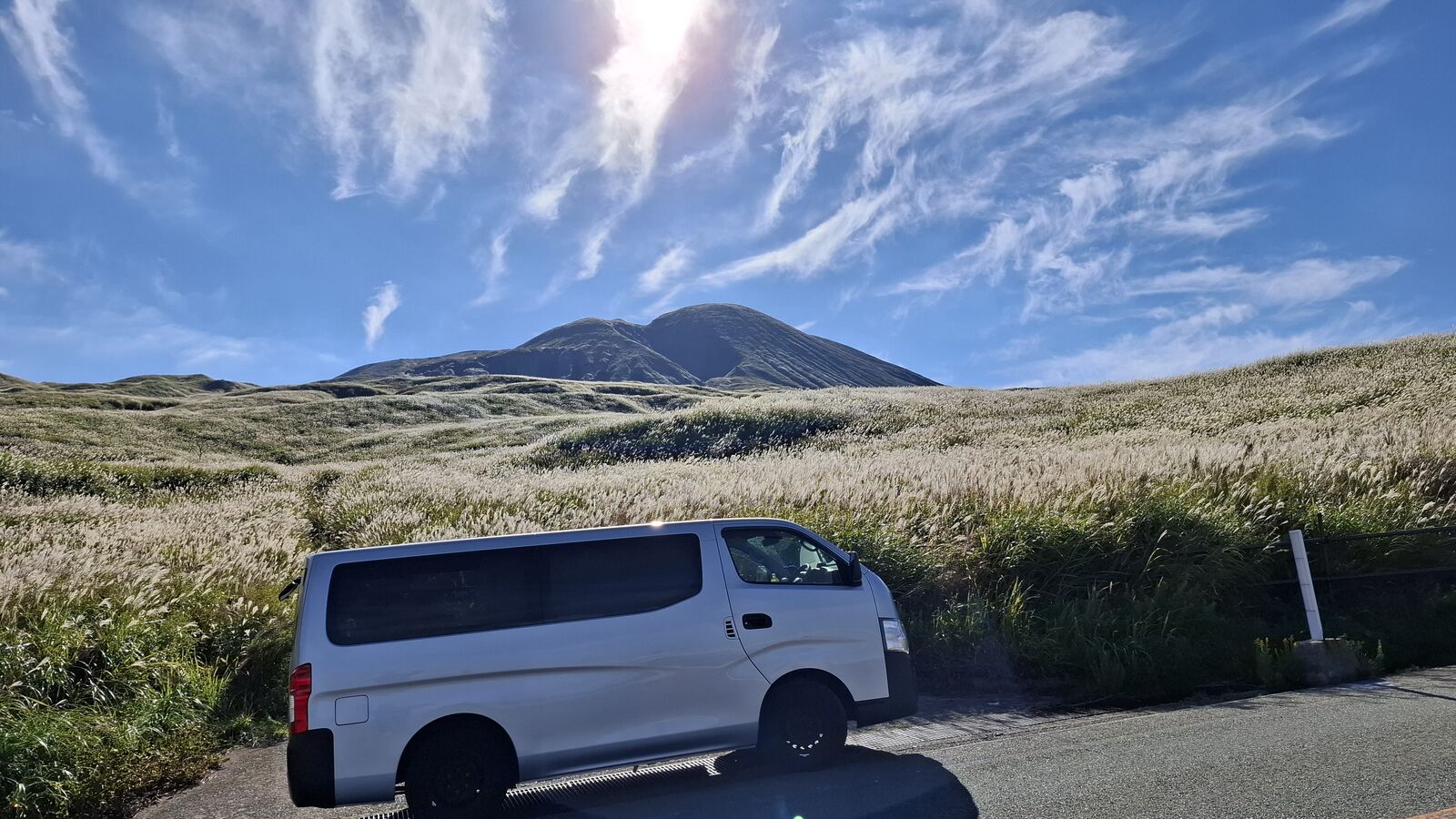
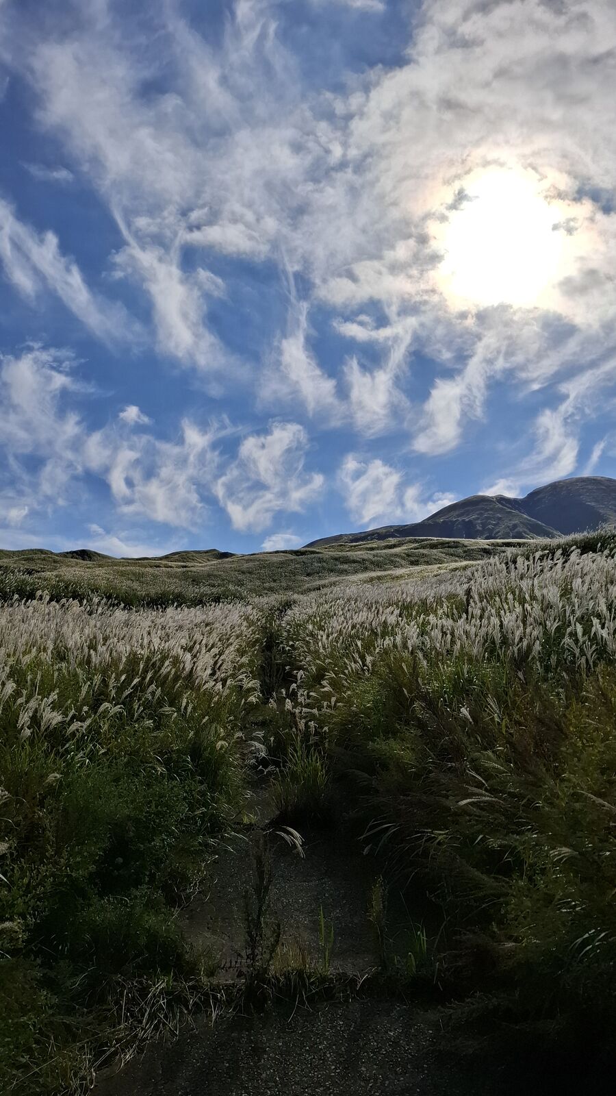
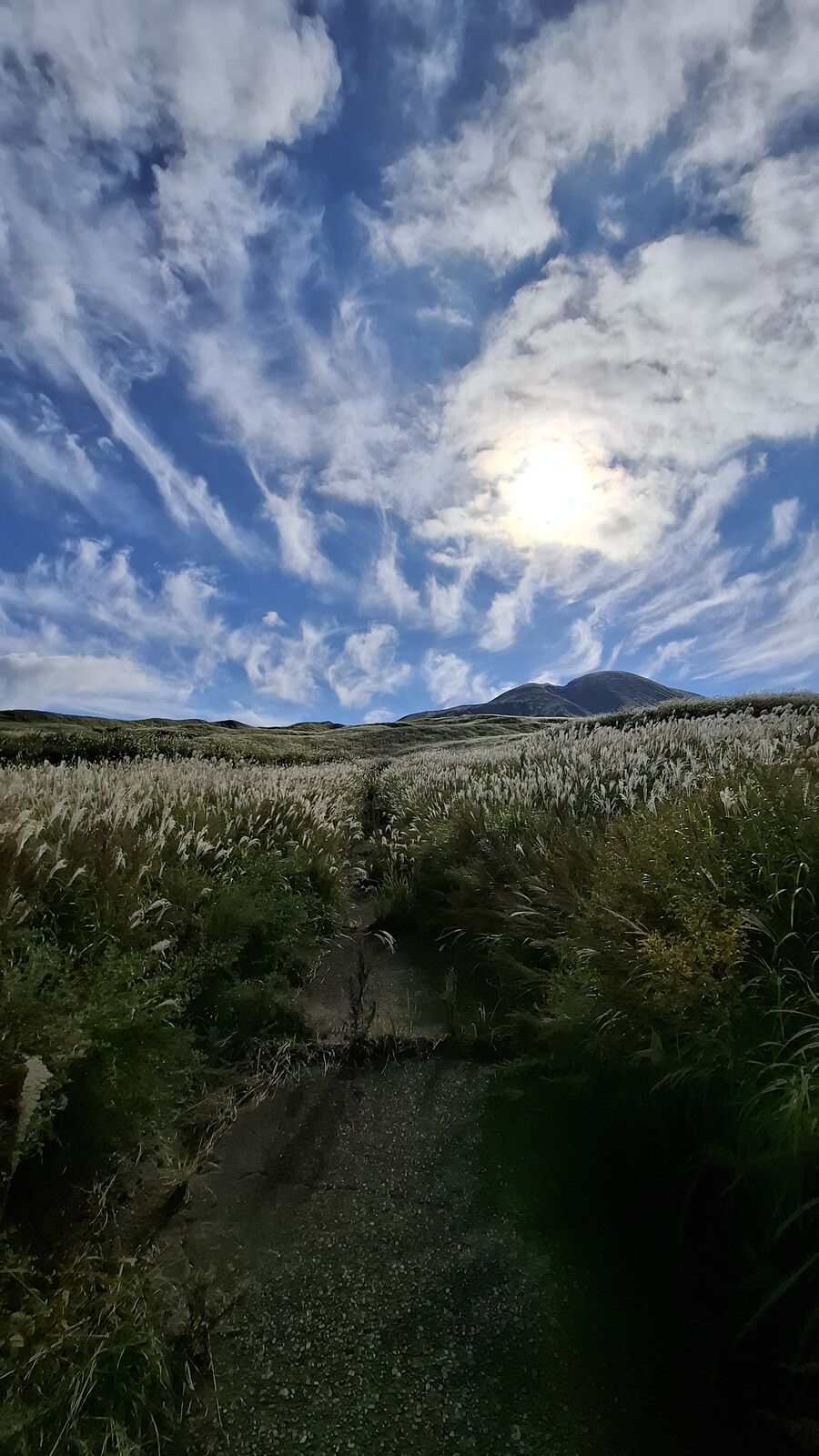
After the crater, I drove through the caldera's western slopes, and the landscape changed again, completely. The grey volcanic desert gave way to rolling hills covered in susuki grass, the tall silver-golden pampas grass that grows across highland Japan in autumn. The fields stretched in every direction, and the wind moved through them in waves. It looked like an ocean, the grass bending and rising in patterns that traveled across the hillside like swells crossing open water.
I parked the van at the edge of the road and just watched. The volcano cone rose behind the grass fields, a perfect dark triangle against the sky, and the susuki caught the afternoon light and turned everything gold and silver. It was the most complete contrast I'd experienced in a single day: from the sterile grey crater where nothing grows and the air can kill you, to this extravagance of living green and gold, all within the same caldera.
I spent the night at a Michi-no-Eki inside the caldera. It was cold up there. The kind of cold that makes you appreciate the van's insulation and a sleeping bag rated for winter. But waking up inside the caldera of one of the world's largest volcanoes felt worth the chill.
Practical Info
Location: Mount Aso (阿蘇山), Aso, Kumamoto Prefecture. Inside the Aso Kuju National Park. View on Google Maps
Access: By car is easiest. The Aso Volcano Road leads up to the Nakadake crater parking lot. Also accessible by bus from JR Aso Station. The crater access road may be closed due to volcanic activity. Check conditions before going.
Cost: Free to enter the caldera area. Crater access road toll varies.
Time needed: Half a day minimum. The crater viewpoint itself takes 30 minutes to an hour. Hiking across the volcanic plain adds 2 to 3 hours. Driving the caldera roads and visiting Kusasenri fills the rest of the day easily.
Safety: This is an active volcano. Gas monitors are installed along the crater path. Concrete evacuation bunkers are placed at intervals. Obey all signs and closures. If the gas alert sounds, leave immediately. People with respiratory conditions should avoid the crater area.
Best conditions: Clear days with blue sky make the volcanic landscape otherworldly. Autumn (October/November) adds the golden susuki grass fields. Winter can be cold inside the caldera.
Crowds: The crater area can be busy with tour groups. The hiking trails beyond the crater are much quieter. I was essentially alone on the volcanic plain.
Combine with: Takachiho Gorge is about an hour east. Kurokawa Onsen is nearby for a hot spring after the hike. The caldera itself is worth a full day of exploration.