There's a book that put this place in my head years before I ever drove here. Alan Booth's "The Roads to Sata" is the account of a man who walked the entire length of Japan in 1977, from Cape Soya in the far north of Hokkaido to Cape Sata at the southern tip of Kyushu. He did it on foot, sleeping in ryokan and drinking with fishermen, and the book he wrote about it became one of the great travel narratives about Japan. I read it on a recommendation from a LinkedIn contact, and then I read everything else Booth wrote. He died in the 1990s in Tokyo, never having left Japan. His walks through the country in the late seventies and eighties captured something about rural Japan that was already disappearing then and is mostly gone now.
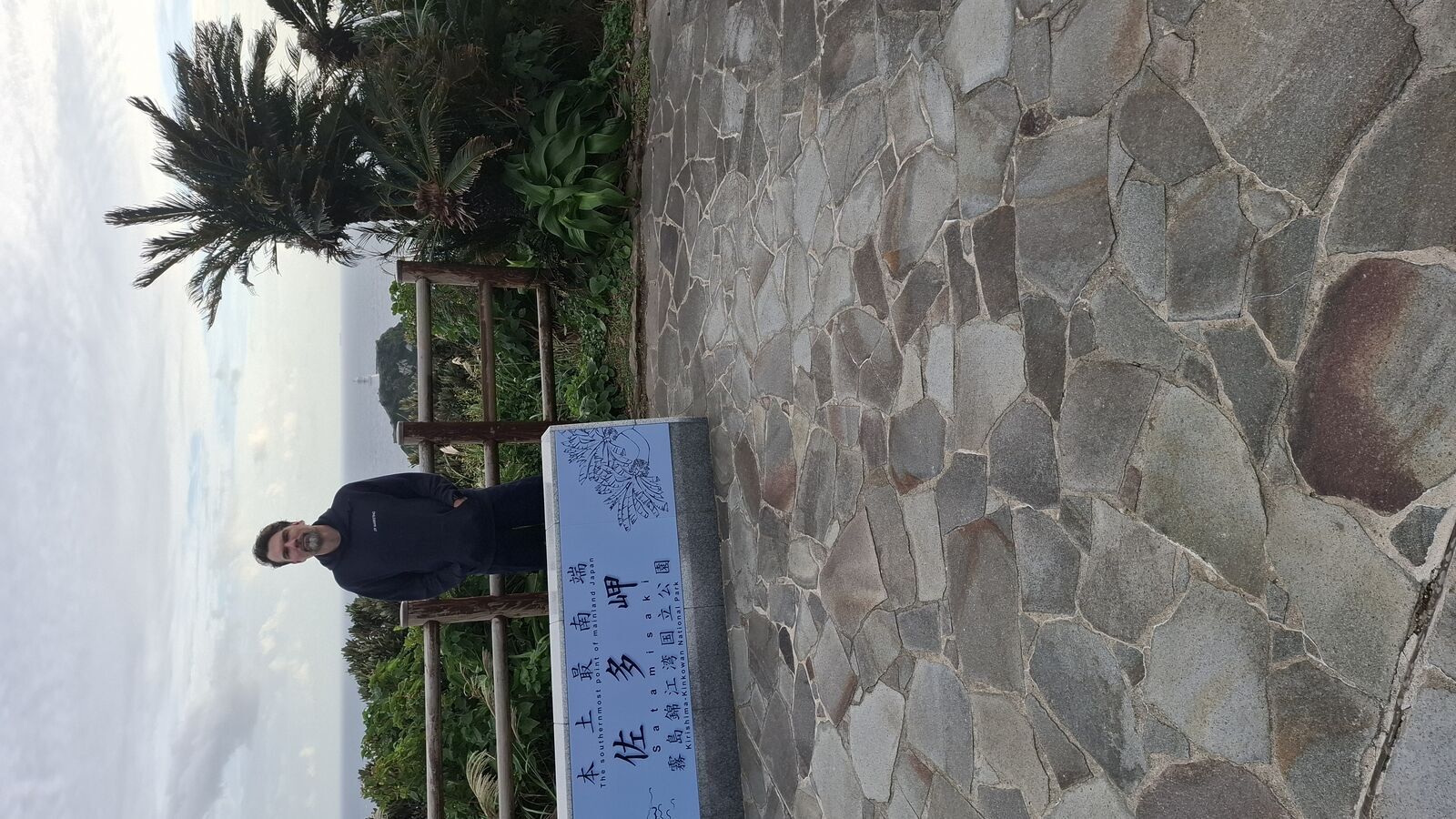
Booth's journey ended here, at the southernmost point of the Japanese mainland. And eventually, after years of thinking about it, mine did too.
The Drive South
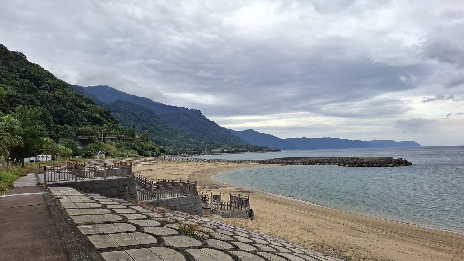
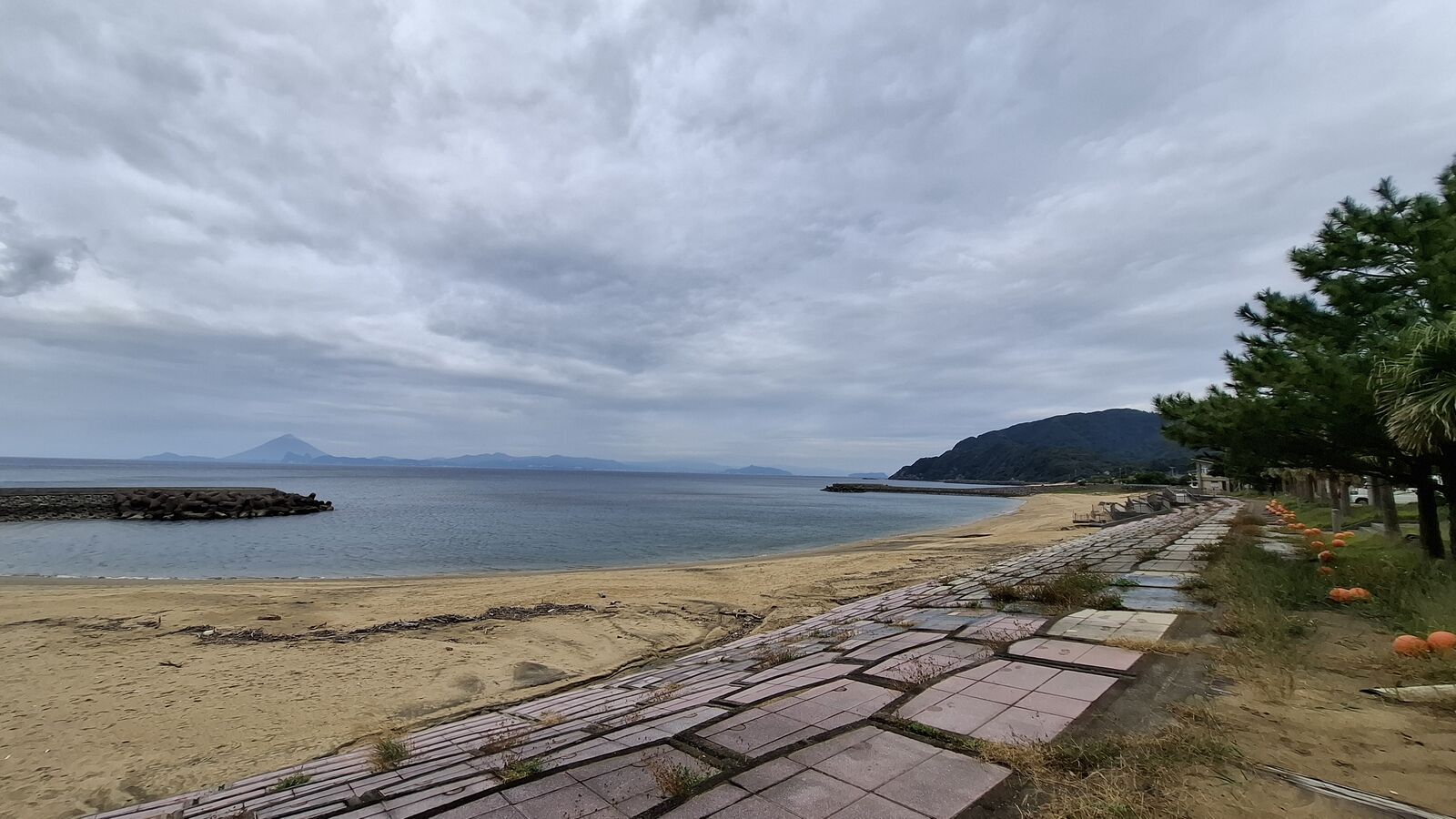
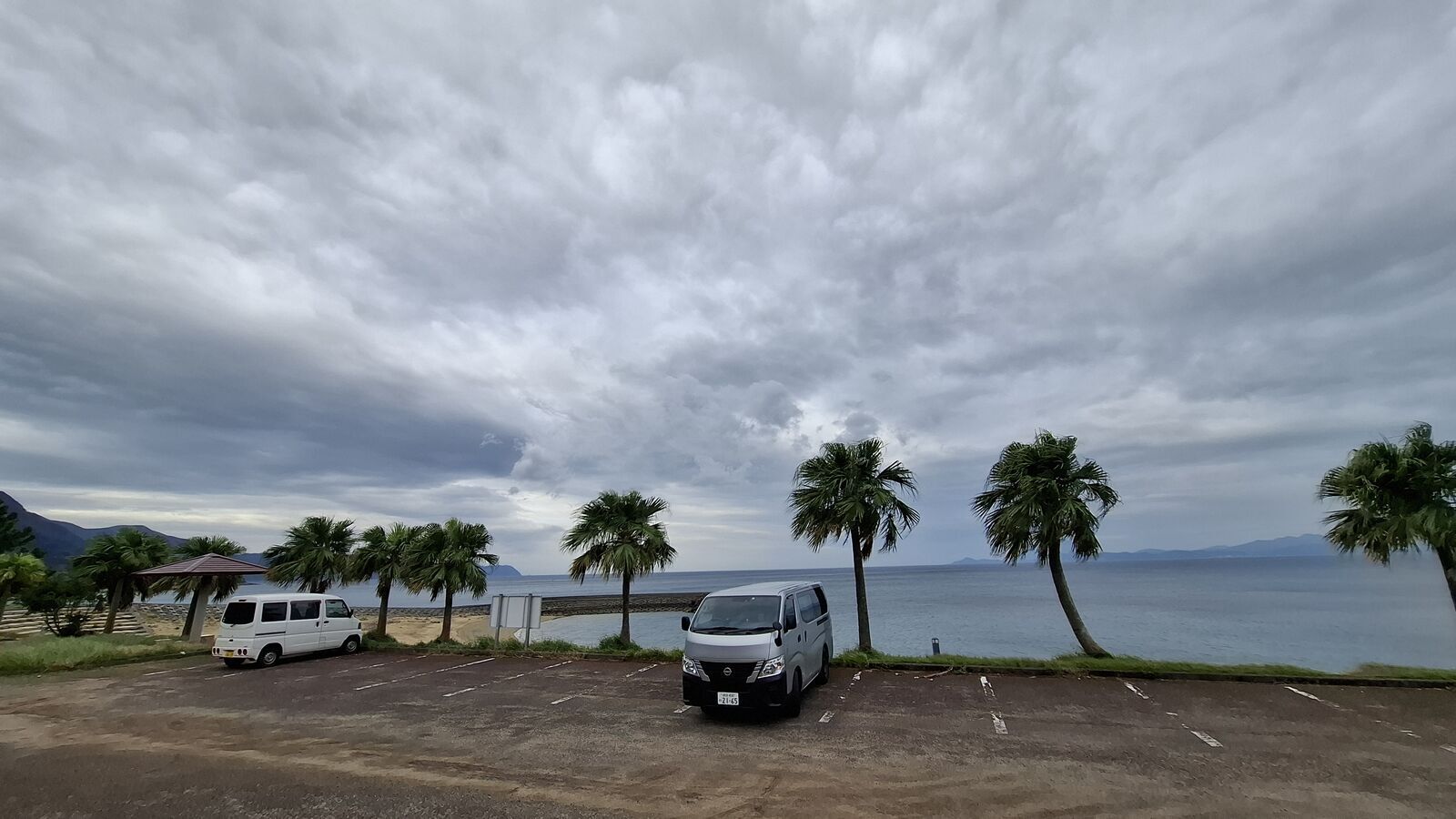
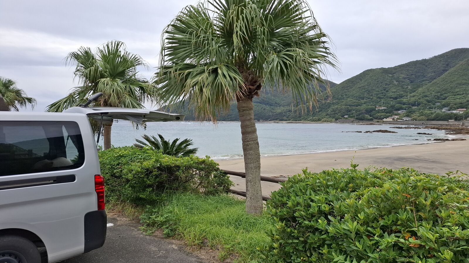
November in Kyushu is mild. The palm trees along the coast are real, not decorative, and the air has a warmth that feels subtropical even in autumn. The drive to Cape Sata takes you down the Osumi Peninsula, past beaches that could be in Southeast Asia, through villages that thin out until there's nothing left but road and ocean. The further south you go, the more it feels like leaving Japan behind and entering somewhere else entirely.
I spent the morning at a beach near the coast, the camper van parked among palm trees, looking out at the ocean under heavy clouds. Mountains rose steeply from the water. There was nobody around. The parking lots along this stretch of coast are oversized and empty, built for a tourism boom that either hasn't arrived or has already passed. By afternoon I was on the final stretch, the road narrowing through tunnels and jungle, and the anticipation was building. This was the place I'd been reading about for years.
The Platform
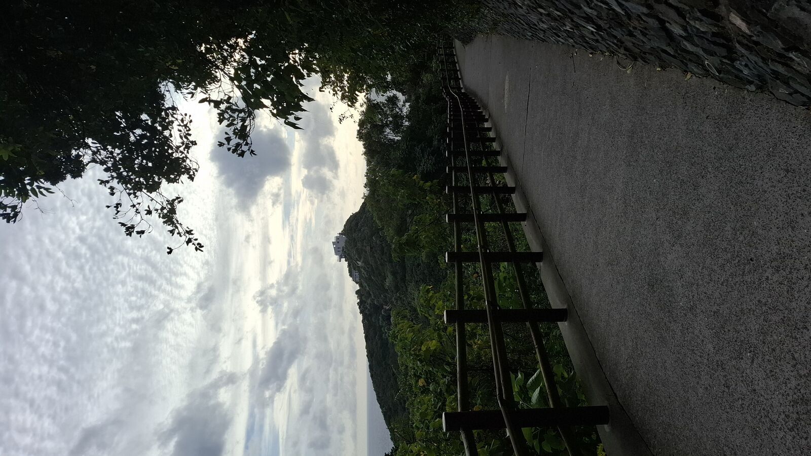
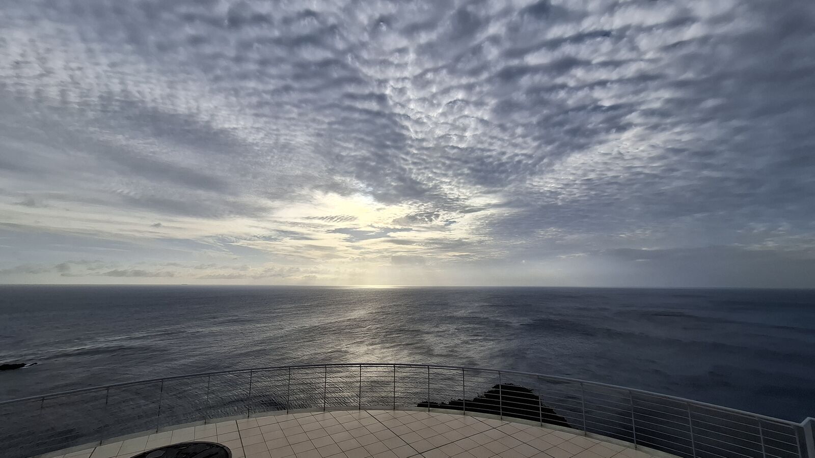
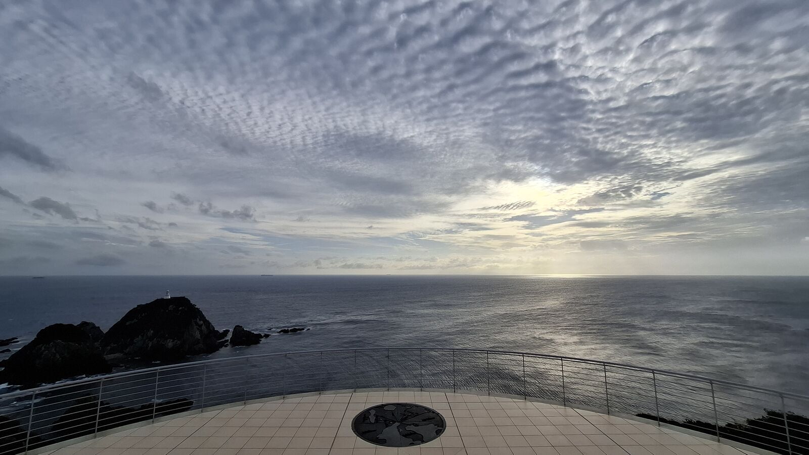
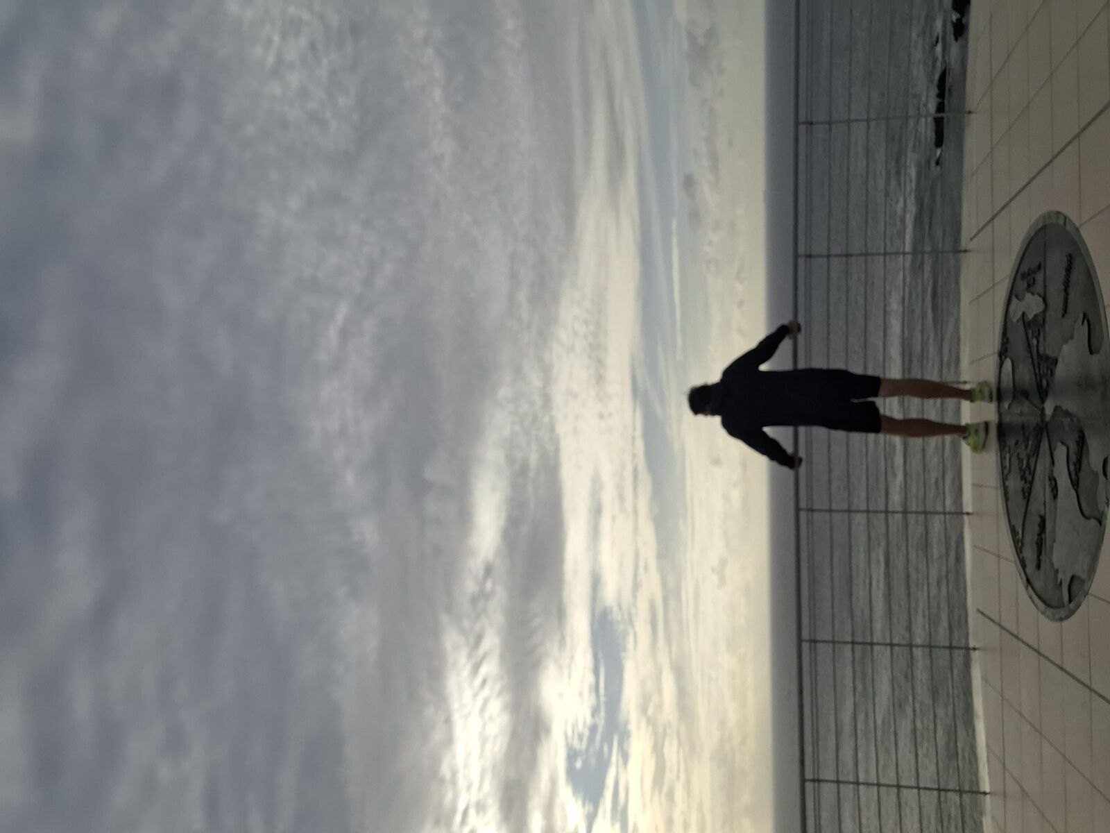
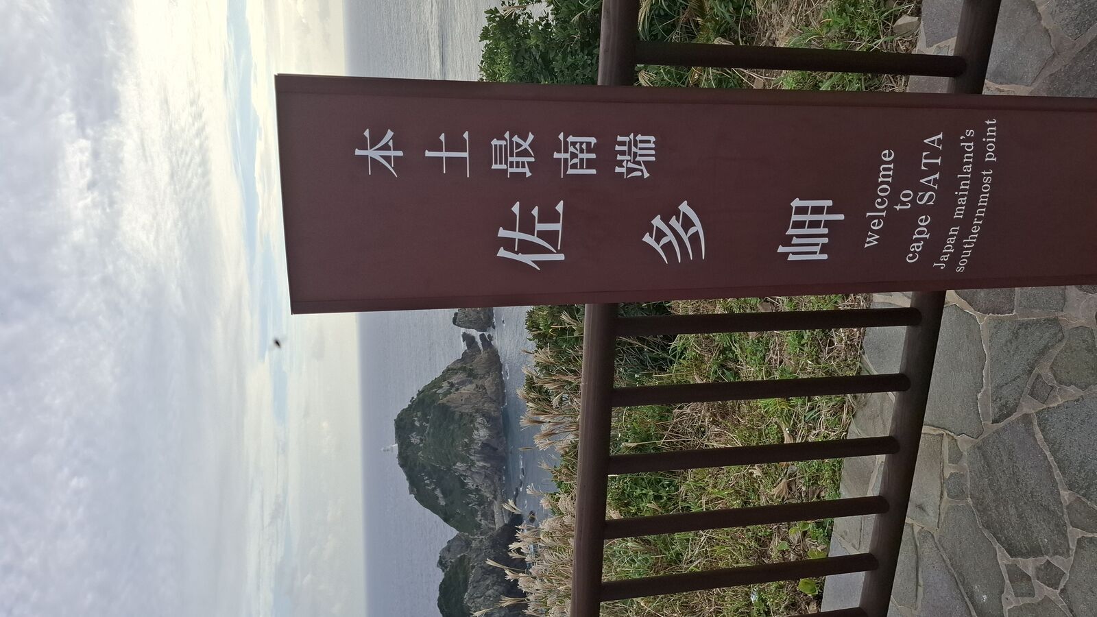
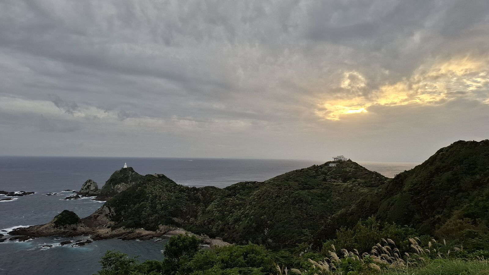
The parking lot at Cape Sata feels like the end of the world. Not in a dramatic way. More like the infrastructure just quietly gave up. There's a visitor center here and a viewpoint at the edge, and from it you can already see the dramatic cliffs dropping into the ocean, the rocky coastline, the lighthouse in the distance. It's a preview of what's ahead. But between you and the cape itself, there's a tunnel cut through the rock. When you come out the other side, the ocean is gone. You're standing in a jungle valley. Dense subtropical vegetation closing in from all sides, no view of anything, just green and a path leading downhill. You follow it through the trees, not knowing how far it goes, and the anticipation builds with every step. Then the jungle thins out, the cliffs reappear, and the path leads along the edge to a concrete observation platform. This is where you stand at the southernmost point of mainland Japan.
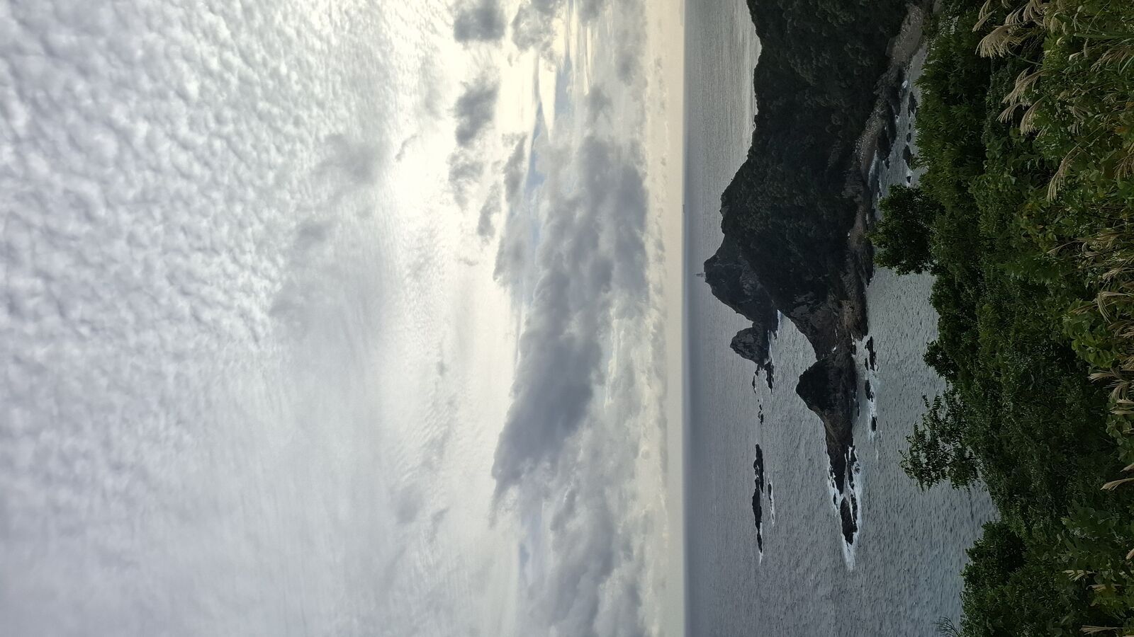
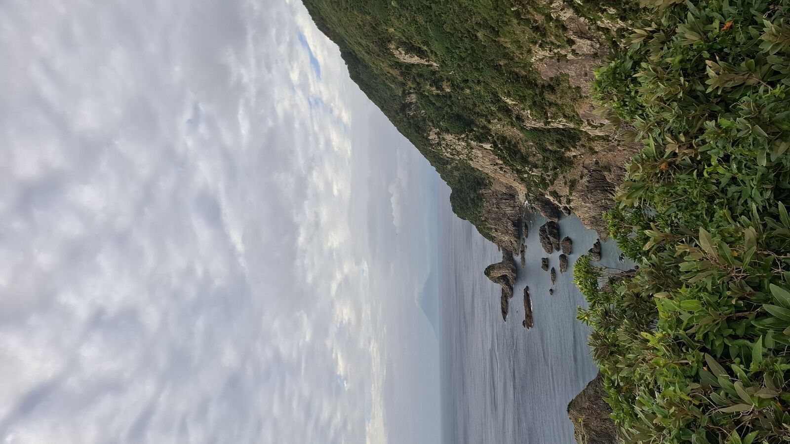
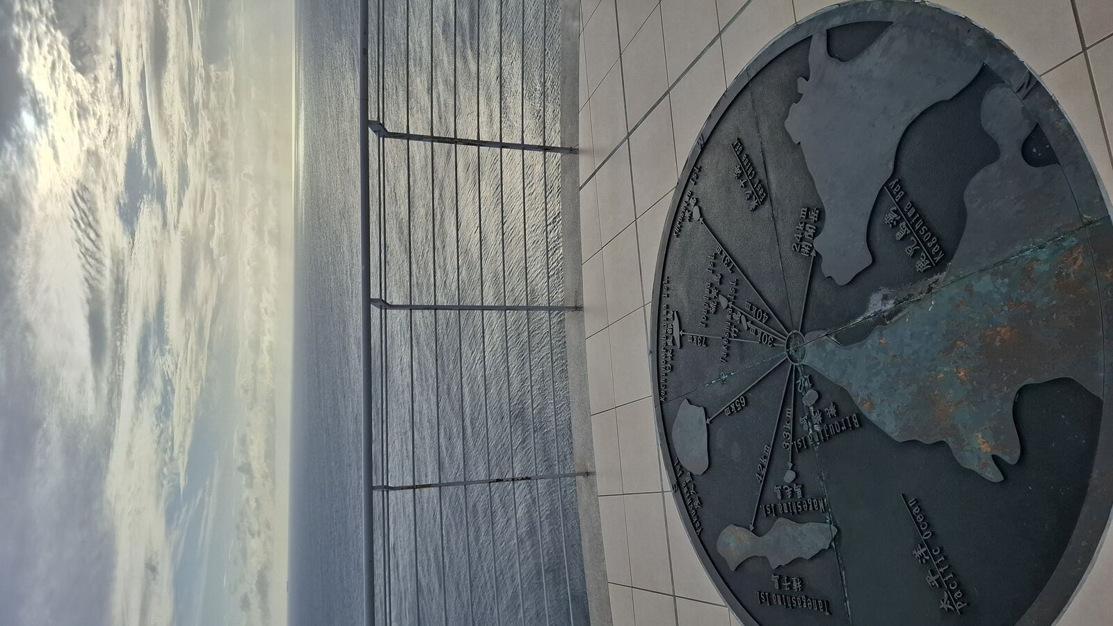
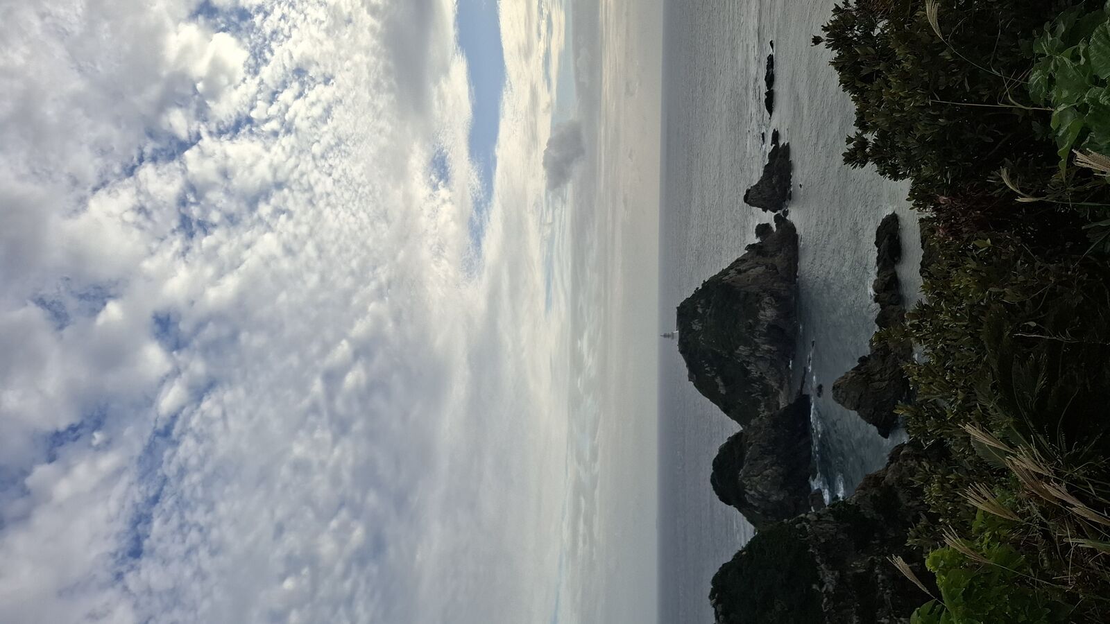
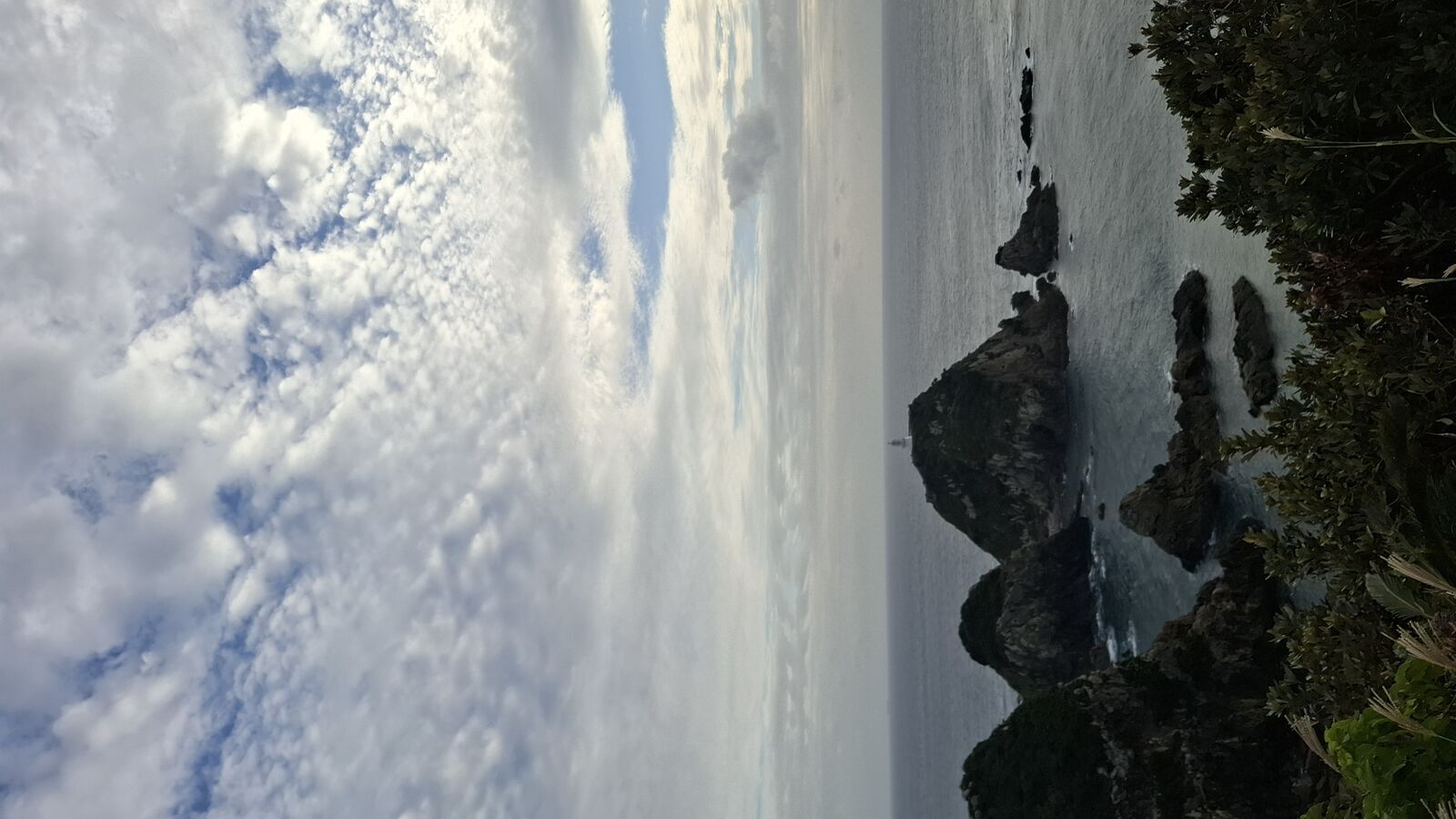
The view is vertigo. Steep cliffs drop into the ocean below, rocks jutting out of the water where waves break white. The lighthouse sits on its own rocky island, unreachable, a white tower built in the 1870s that has been guiding ships through these waters for over a hundred and fifty years. On the platform floor there's a compass rose mosaic showing the distances to other capes and landmarks, and you realize you're standing further south than you've ever been in Japan. Okinawa is somewhere out there beyond the horizon.
The sun was breaking through the clouds in sheets of light that moved across the water like searchlights. I stood there for a long time. There was nobody else. Just wind, waves, and the feeling of having arrived at a place that took years to reach.
Through the Jungle
The paths around the cape lead through subtropical jungle that feels nothing like the Japan most visitors know. Banyan-like trees with aerial roots that hang like curtains. Palm fronds and tropical vines that swallow everything they touch. And hidden in this jungle, things you don't expect to find.
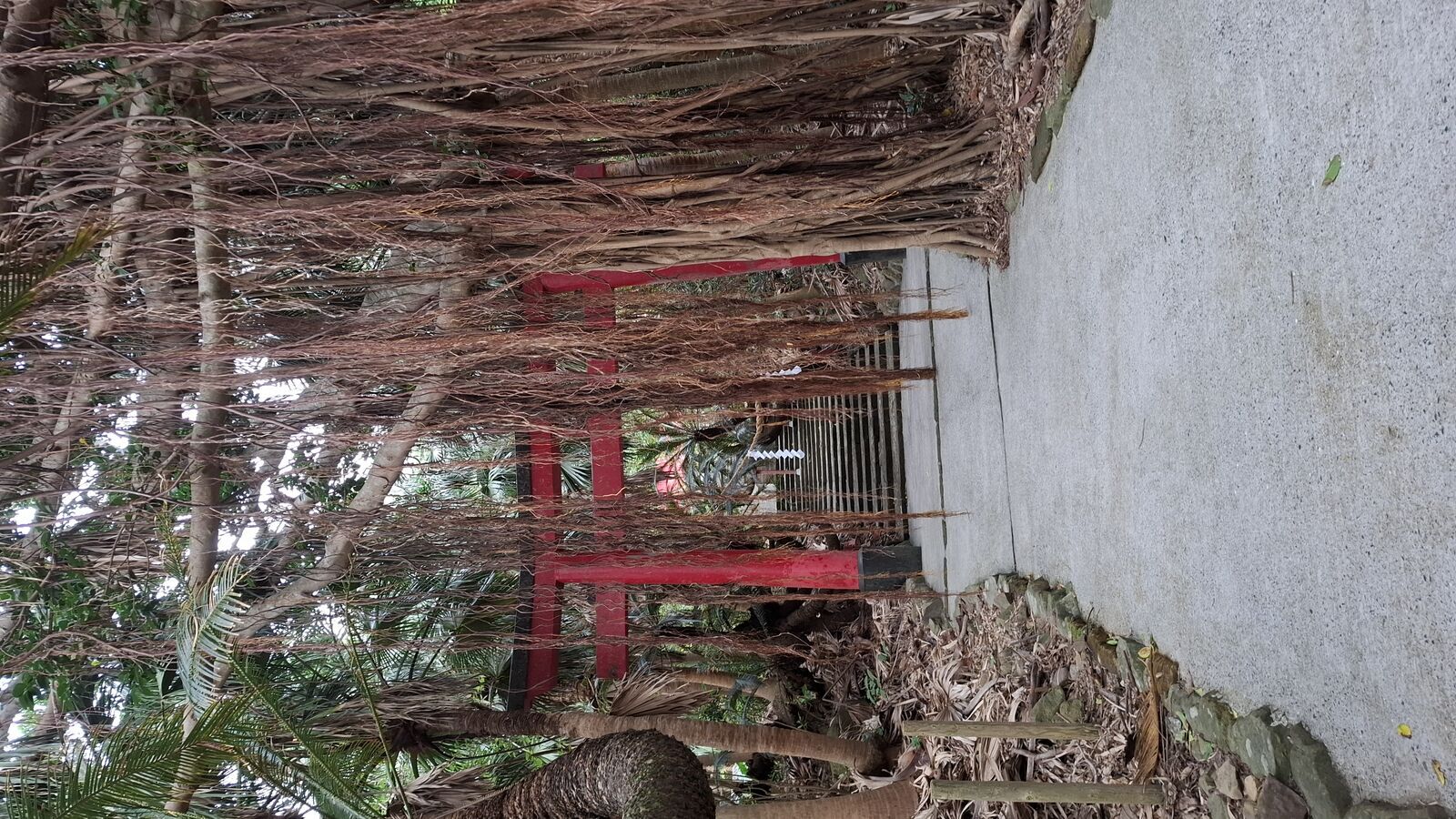
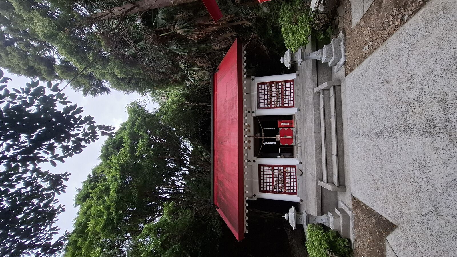
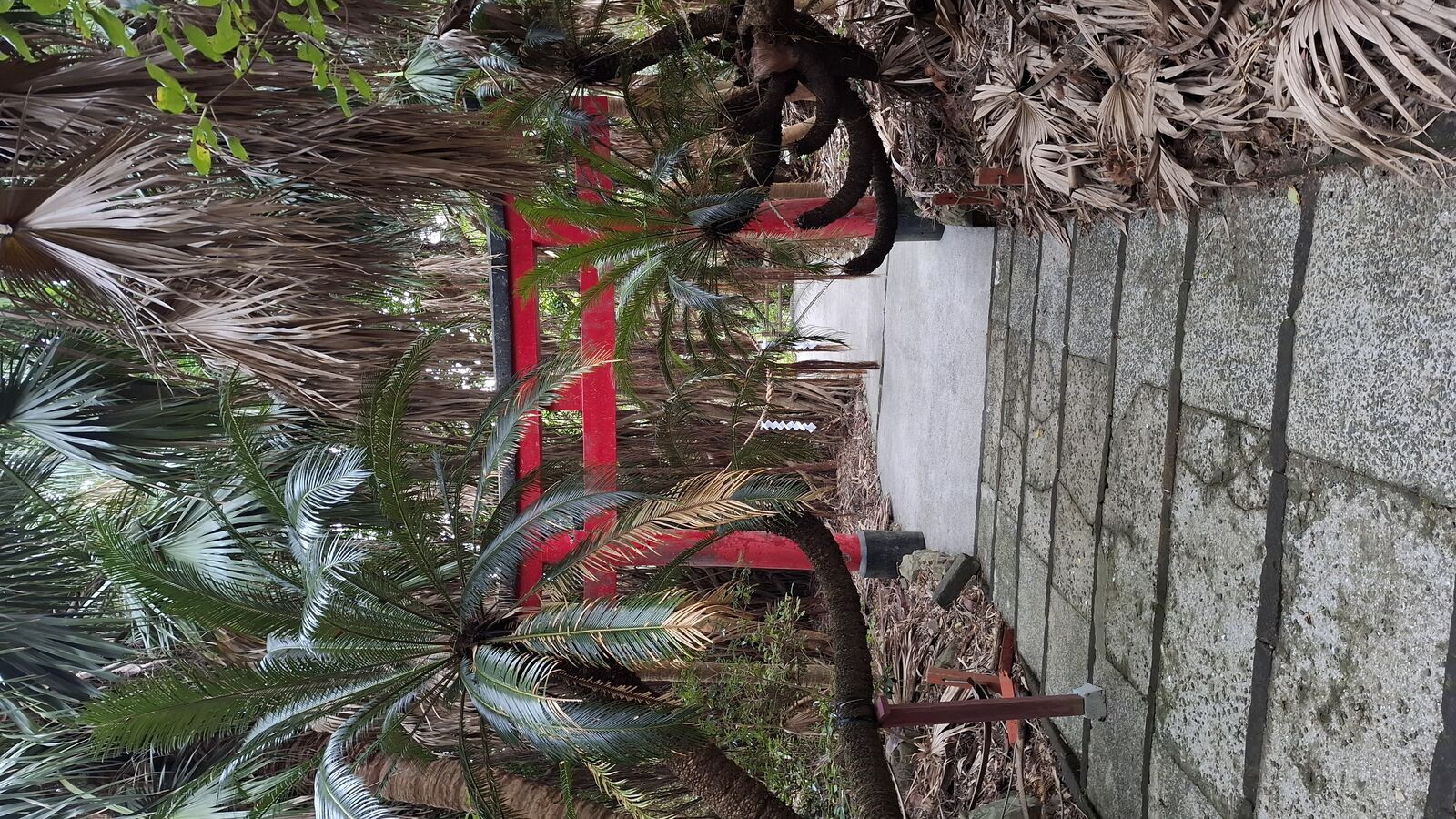
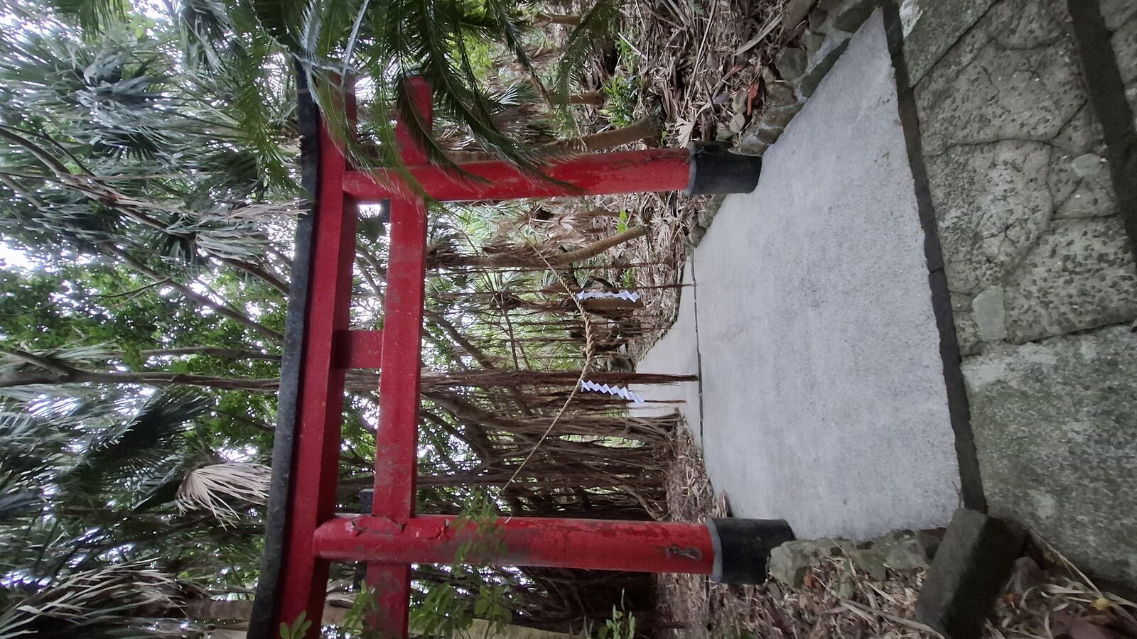
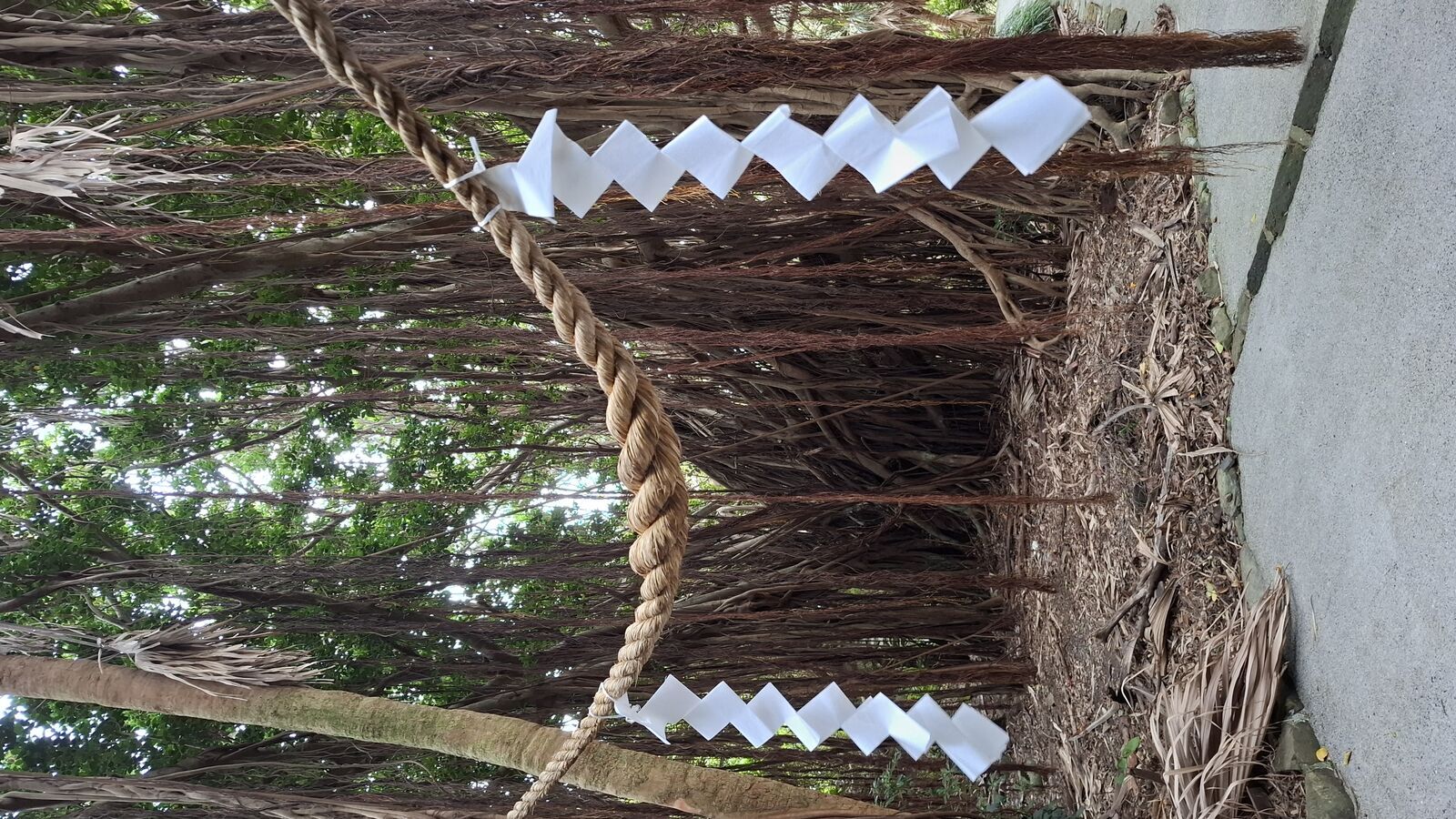
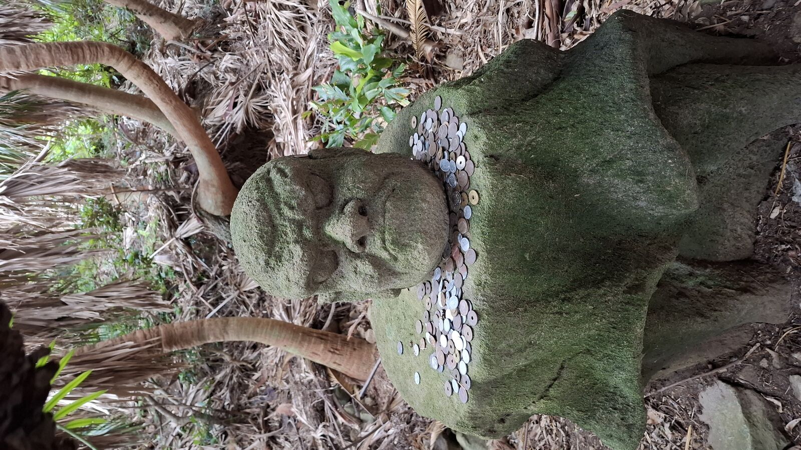
There's a Shinto shrine here, its red torii gate almost invisible under the vegetation that has grown over and through it. Vines wrap around the pillars, roots push through the stone walls, and the whole structure looks like the jungle is slowly pulling it underground. Behind the torii, a small red shrine building sits in a clearing, its white and red lattice still bright against the dark green. A shimenawa rope hangs from an ancient tree, paper streamers moving in the breeze. And nearby, a small moss-covered stone figure sits among tropical plants, coins placed as offerings at its feet. Someone still comes here to pray.
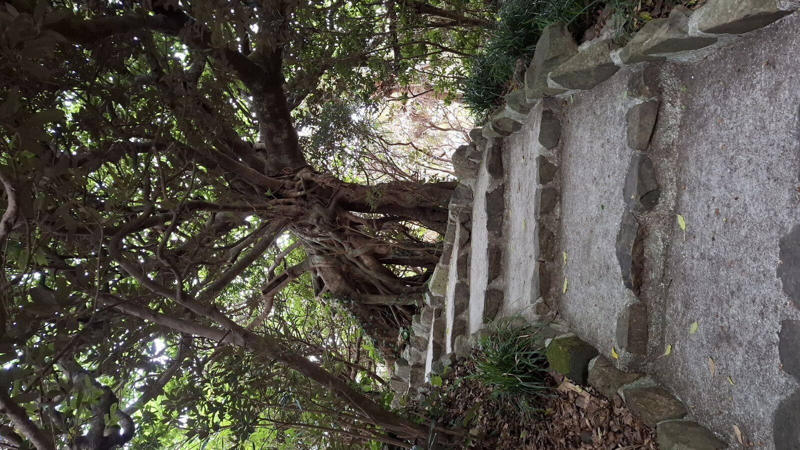
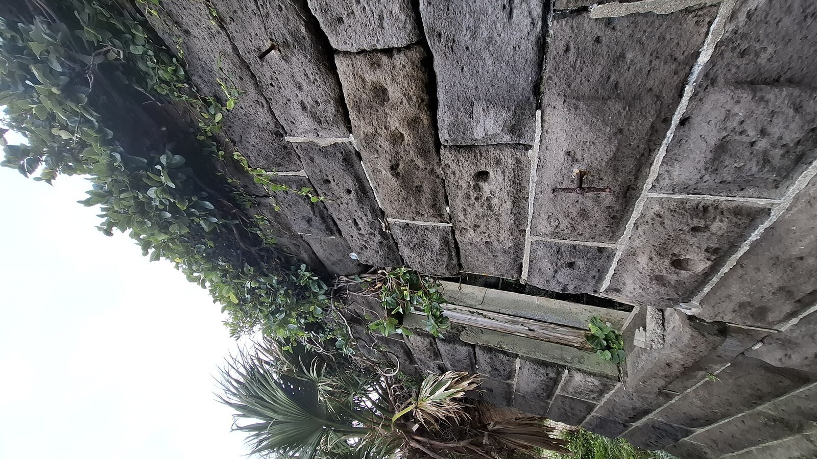
Further along, the stone ruins of the old lighthouse keepers' houses stand roofless and overgrown. These were built by the British in the 1870s, when Scottish engineers came to construct lighthouses along Japan's coast for the safety of the trade fleet. The houses had Western-style stone walls and proper fireplaces, built for men who lived at the literal edge of the country. Now the walls are crumbling and vines grow through the empty windows. It's the kind of ruin that tells two stories at once: the ambition of building something permanent in an impossible place, and nature's patient response.
Booth's Finish Line
Alan Booth walked for months to get here. He crossed the entire country on foot, through typhoons and hangovers and encounters with people who couldn't understand why a foreigner would do such a thing. When he finally reached Cape Sata, he didn't describe some grand epiphany. He was tired, and it was over, and that was enough.
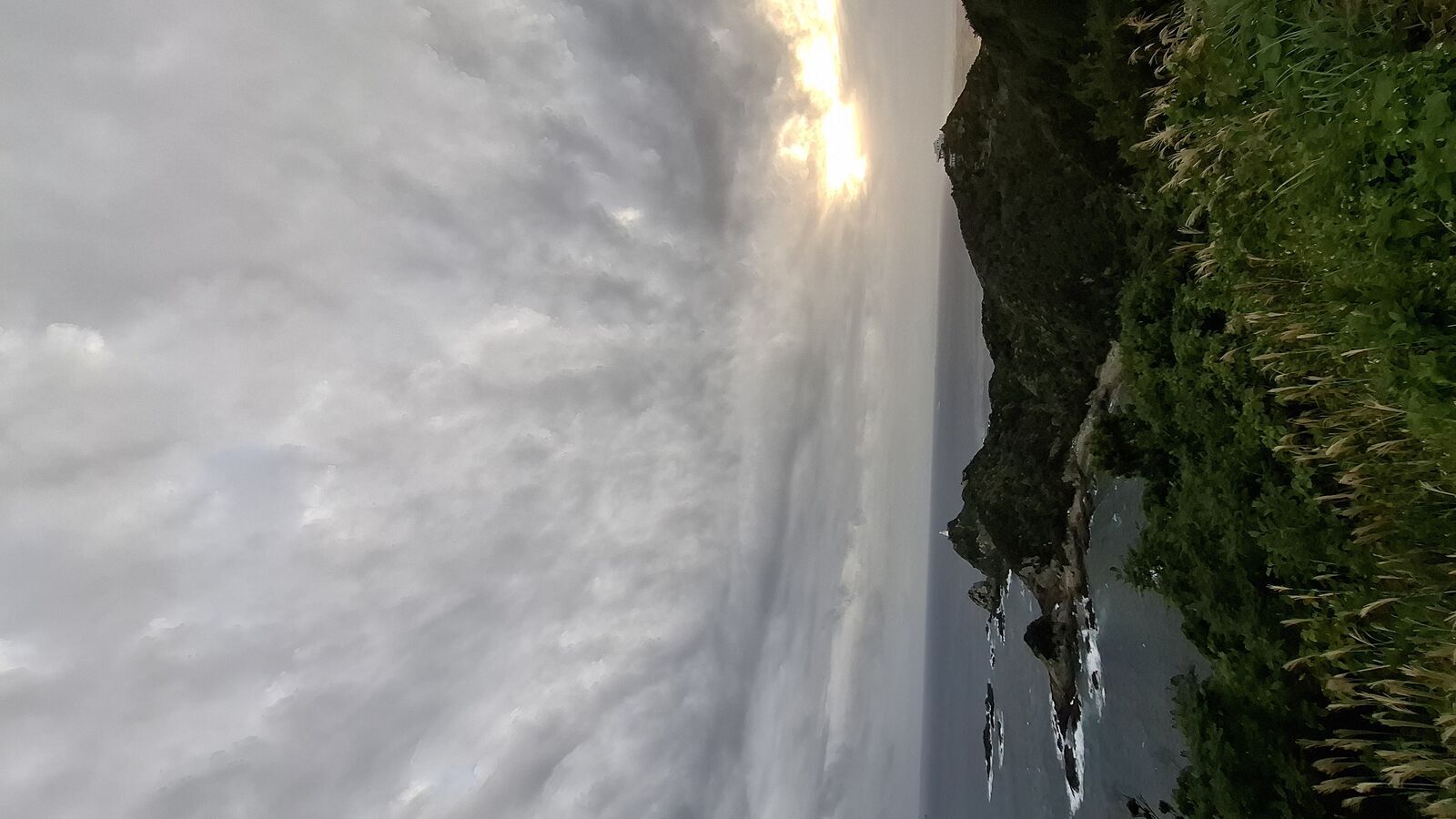
I arrived by camper van, which is considerably less heroic. But standing on that platform in the late afternoon light, I understood something about why he walked here and not somewhere else. There's a finality to Cape Sata that no other place in Japan has. It's not just the end of a peninsula. It's the end of the road, the end of the mainland, the last piece of solid ground before the ocean takes over. Every journey needs a destination that means something, even if the meaning is just geographical. Booth chose the southernmost point of the country, and when you stand there, you understand why.
The Doors were playing in my head as I walked back through the jungle in the golden light. This is the end, beautiful friend. Not because anything was ending, but because the song has always been about arriving at a place where there's nothing left to do but look at what's in front of you. Cape Sata is that kind of place.
Practical Info
Location: Cape Sata (佐多岬), Minamiōsumi, Kagoshima Prefecture. The southernmost point of mainland Japan, at the tip of the Ōsumi Peninsula. View on Google Maps
Access: By car only, realistically. About 1.5 hours from Kanoya, 2.5 hours from Kagoshima City. The road is well-maintained but remote. No rail access.
Cost: Free. The observation platform and park area have no entrance fee.
Time needed: 1 to 2 hours to walk the paths, visit the viewpoint, explore the shrine and ruins. More if you want to sit and absorb the atmosphere.
Best conditions: Late afternoon for golden light on the cliffs and lighthouse. Cloudy days create dramatic skies. Autumn and spring are comfortable. Summer is hot and subtropical.
Crowds: I was completely alone in the late afternoon in November. During the day there may be other visitors, but this is not a crowded destination even in peak season.
Combine with: The drive along the Ōsumi coast is beautiful in itself. Sata is a natural endpoint for a Kyushu road trip. Sakurajima and Kagoshima City are within day-trip distance to the north.